Toggle navigation
LMEC Home
Exhibitions
Georeferencing
Tools for Teachers
Collections
My Favorites
Sign Up / Log In
Search
Search the map portal
Map Collection
Map Collection
Map Sets
Search
Search
Search for
Search In
All Fields
Creator
Title
Subject
Place
Search All Digital Collections
Advanced Search
110 Results
My Search
Start Over
More Like
commonwealth:31982x21w
Remove constraint More Like: commonwealth:31982x21w
Filter your Search
Place
North and Central America
95
United States
93
Massachusetts
62
Virginia
13
Boston
8
Plymouth (county)
8
Suffolk (county)
8
Bristol (county)
5
more
Place
»
Topic
Massachusetts--Maps
19
United States--History--Civil War, 1861-1865--Maps
10
Plymouth County (Mass.)--Maps
8
Land use--Massachusetts--Maps
7
Virginia--History--Civil War, 1861-1865--Maps
7
Bristol County (Mass.)--Maps
6
Connecticut--Maps
5
Watersheds--Massachusetts--Maps
5
more
Topic
»
Date
Date range begin
–
Date range end
Current results range from
1793
to
2015
View distribution
Creator
MassGIS (Office : Mass.)
21
Massachusetts. Executive Office of Environmental Affairs
16
Michler, N. (Nathaniel), 1827-1881
15
New York Lithographing, Engraving and Printing Co.
12
Strasser, J.
12
Theilkuhl, F.
12
Weyss, J. E.
12
Geological Survey (U.S.)
10
more
Creator
»
Format
Maps/Atlases
107
Ephemera
2
Books
1
Documents
1
Posters
1
Georeferenced
Yes
1
No
109
Collection
Norman B. Leventhal Map & Education Center Collection
106
David Judkins Weaver Papers
96
Boston and New England Maps
69
Urban Maps
9
Massachusetts Real Estate Atlases
4
Applied Geographics, Inc. Records
2
Available to use
No known restrictions
106
Search Constraints
Sort by relevance
relevance
title
date (asc)
date (desc)
Number of results to display per page
20 per page
10
per page
20
per page
50
per page
100
per page
View results as:
grid view
map view
Search Results
41.
Gnomonic projection : polar-equatorial
42.
Gulf of Maine watershed : with major river basins
43.
Harper's Ferry
44.
High Bridge and Farmville
45.
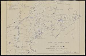
Indian tribal occupation areas and historic sites 1500-1600 in the northeastern United States and Canadian Maritimes
46.
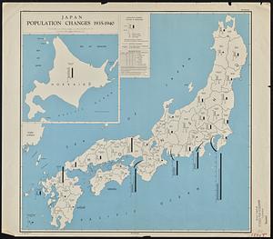
Japan, population changes 1935-1940
47.
Jetersville and Sailors Creek
48.
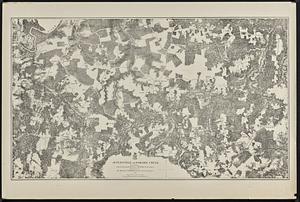
Land use in northern Worcester County, Mass. ; open spaces and protected areas in the northern Worcester County, Mass.
49.
Land use shading test plot shadeset PI and lu21-pi.lut
50.
Major thoroughfare system, city of Boston, June 1972
51.
Major transportation system : Boston region MAPC area
52.
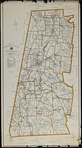
Map of Berkshire County, Massachusetts
53.
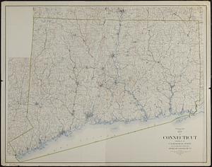
Map of Connecticut
54.
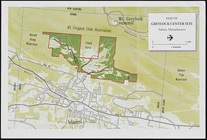
Map of Greylock center site, Adams, Massachusetts
55.
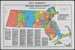
Map of Massachusetts : state Senate legislative districts : (Chapter 305 of the Acts of 1987)
56.
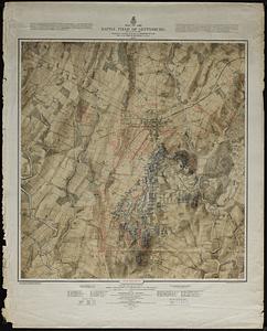
Map of the battle field of Gettysburg : July 1st, 2nd, 3rd, 1863
57.
Map of United States showing drainage areas and index numbers
58.
Massachusetts areas of critical environmental concern
59.
Massachusetts coastal zone management program : volume 1, summary map
60.
Massachusetts drainage basins
‹ Prev
Next ›
1
2
3
4
5
6