Toggle navigation
LMEC Home
Exhibitions
Georeferencing
Tools for Teachers
Collections
My Favorites
Sign Up / Log In
Search
Search the map portal
Map Collection
Map Collection
Map Sets
Search
Search
Search for
Search In
All Fields
Creator
Title
Subject
Place
Search All Digital Collections
Advanced Search
429 Results
My Search
Start Over
More Like
commonwealth:2v242c61w
Remove constraint More Like: commonwealth:2v242c61w
Filter your Search
Place
North and Central America
380
United States
242
North America
69
Canada
62
New York
49
Pennsylvania
43
New Jersey
20
Asia
17
more
Place
»
Topic
North America--Maps--Early works to 1800
60
United States--Maps--Early works to 1800
43
Canada--Maps--Early works to 1800
38
Pennsylvania--Maps--Early works to 1800
37
New York (State)--Maps--Early works to 1800
34
New Jersey--Maps--Early works to 1800
17
Northeastern States--Maps--Early works to 1800
16
New England--Maps--Early works to 1800
14
more
Topic
»
Date
Date range begin
–
Date range end
Current results range from
1623
to
1999
View distribution
Creator
Jefferys, Thomas, -1771
22
Faden, William, 1749-1836
17
Bellin, Jacques Nicolas, 1703-1772
16
Robert Sayer and John Bennett (Firm)
15
Gibson, J. (John), active 1750-1792
14
Carleton, Osgood, 1742-1816
13
Sayer, Robert, 1725-1794
13
Kitchin, Thomas, 1719-1784
11
more
Creator
»
Format
Maps/Atlases
427
Manuscripts
5
Paintings
3
Ephemera
1
Objects/Artifacts
1
Prints
1
Georeferenced
Yes
4
No
425
Collection
MacLean Collection Map Library
379
American Revolutionary War-Era Maps
371
Norman B. Leventhal Map & Education Center Collection
25
New York Public Library Collection
12
Richard H. Brown Revolutionary War Map Collection at Mount Vernon
8
British Library Collection
2
Mapping Boston Collection
2
Sidney R. Knafel Map Collection at Phillips Academy
2
more
Collection
»
Available to use
Creative Commons license
24
No known restrictions
23
Search Constraints
Sort by relevance
relevance
title
date (asc)
date (desc)
Number of results to display per page
20 per page
10
per page
20
per page
50
per page
100
per page
View results as:
grid view
map view
Search Results
201.
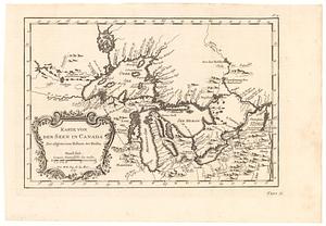
Karte von den seen in Canada zur allgemeinen historie der reisen
202.
Karte von Luisiana, dem laufe des Mississipi und den benachbaerten laendern
203.
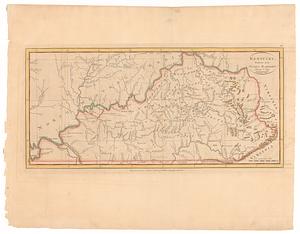
Kentucky, reduced from Elihu Barker's large map
204.
Krigs theatren i America = Seat of war in America
205.
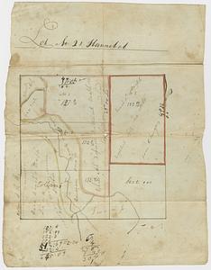
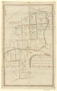
Lot no. 21 Hannibal
206.
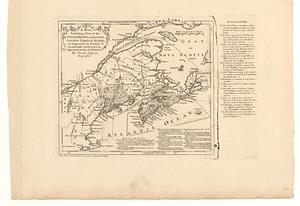
A map, exhibiting a view of the English rights, relative to the ancient limits of Acadia; as supported by express &...
207.
A map exhibiting all the new discoveries, in the interior parts of North America : inscribed by permission to the honorable...
208.
A map exhibiting all the new discoveries in the interior parts of North America inscribed by permission to the honorable...
209.
A map exhibiting all the new discoveries in the interior parts of North America inscribed by permission to the honorable...
210.
A map of a tract of land granted on the 30th May 1769 to Jacob H. Ten Eyck and three other persons laid into lots
211.
A map of America, between latitudes 40 and 70 north, and longitudes 45 and 180 west : exhibiting Mackenzie's track from...
212.
A map of Canada and the north part of Louisiana with the adjacent countrys
213.
Map of Japan plate
214.
Map of London : from an actual survey made in the years 1824, 1825 & 1826
215.
A map of Louisiana with the course of the Missisipi, and the adjacent rivers, the nations of the natives, the French...
216.
A map of Mackenzie's track, from Fort Chipewyan to Pacific Ocean in 1793
217.
Map of Massachusetts proper : compiled from actual surveys made by order of the general court, and under the inspection of...
218.
A map of Messrs: Gorham & Phelps's purchase; now the county of Ontario in the state of New York
219.
Map of New-Haven and its environs
220.
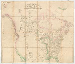
A map of North America
‹ Prev
Next ›
1
2
…
7
8
9
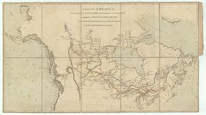
10
11
12
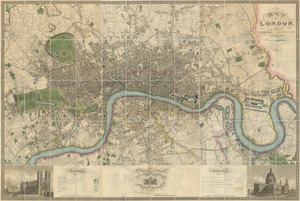
13
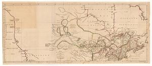
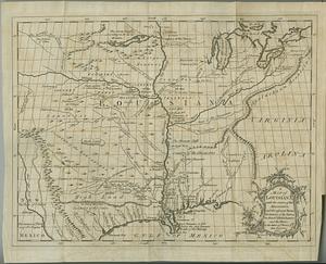
14
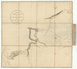
15
…
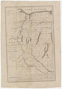
21
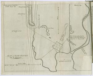
22