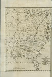
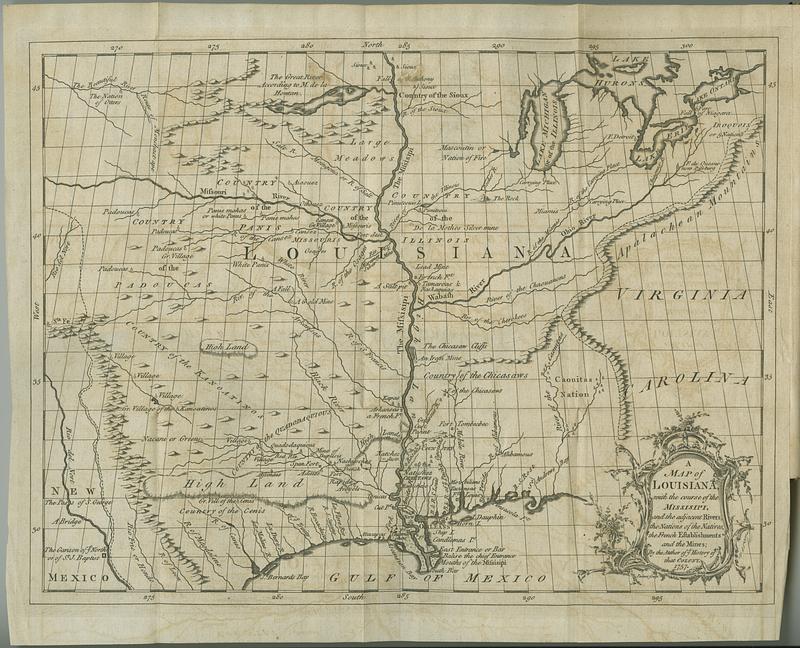
A map of Louisiana with the course of the Missisipi, and the adjacent rivers, the nations of the natives, the French establishments and the mines
This map is also available in American Revolutionary Geographies Online (ARGO), a collections portal especially built for material relating to the American Revolutionary War Era. Visit ARGO to learn more about this item and explore the historical geography of North America in the late eighteenth century.
Item Information
- Title:
- A map of Louisiana with the course of the Missisipi, and the adjacent rivers, the nations of the natives, the French establishments and the mines
- Contributor:
- Le Page du Pratz, -1775
- Publisher:
- Becket, Thomas
- Name on Item:
-
by the author of ye history of that colony
- Date:
-
1774
- Format:
-
Maps/Atlases
- Location:
- MacLean Collection Map Library
- Collection (local):
-
MacLean Collection Map Library
- Subjects:
-
Indians of North America--United States--Maps
United States--Maps--Early works to 1800
- Places:
-
United States
- Extent:
- 2 maps ; 349 x 292 mm and 191 x 229 mm
- Terms of Use:
-
Public Domain/No known restrictions on use. Contact host institution to download image.
Contact host institution for more information.
- Publisher:
-
London :
Becket, Thomas
- Language:
-
English
- Notes:
-
In Du Pratz's The history of Louisiana, or of the western parts of Virginia and Carolina (London: Printed for T. Becket, 1774).
- Identifier:
-
MC_2774
- Call #:
-
2774