Toggle navigation
LMEC Home
Exhibitions
Georeferencing
Tools for Teachers
Collections
My Favorites
Sign Up / Log In
Search
Search the map portal
Map Collection
Map Collection
Map Sets
Search
Search
Search for
Search In
All Fields
Creator
Title
Subject
Place
Search All Digital Collections
Advanced Search
527 Results
My Search
Start Over
More Like
commonwealth:2f75r928q
Remove constraint More Like: commonwealth:2f75r928q
Filter your Search
Place
North and Central America
524
United States
518
Suffolk (county)
500
Boston
498
Massachusetts
76
South End
49
Roxbury
47
Downtown Boston
40
more
Place
»
Topic
City planning--Massachusetts--Boston--Maps
417
Urban renewal--Massachusetts--Boston--Maps
253
Boston (Mass.)--Maps
126
Land use--Massachusetts--Boston--Maps
101
Buildings--Massachusetts--Boston--Maps
80
Real property--Massachusetts--Boston--Maps
49
Roxbury (Boston, Mass.)--Maps
43
South End (Boston, Mass.)--Maps
42
more
Topic
»
Date
Date range begin
–
Date range end
Current results range from
1775
to
2003
View distribution
Creator
Boston Redevelopment Authority
368
Downtown Waterfront Corporation
10
Victor Gruen Associates
10
Boston (Mass.). Parks and Recreation Department
8
O.H. Bailey & Co
6
Sasaki Associates
6
Boston (Mass.). Department of Parks
5
Charles A. Maguire and Associates
5
more
Creator
»
Format
Maps/Atlases
526
Drawings/Illustrations
3
Manuscripts
2
Prints
1
Georeferenced
Yes
5
No
522
Collection
Boston and New England Maps
512
Urban Maps
482
Boston Redevelopment Authority Collection
439
Norman B. Leventhal Map Center Collection
139
American Revolutionary War-Era Maps
2
Mapping Boston Collection
2
Maritime Charts and Atlases
1
New York Public Library Collection
1
more
Collection
»
Available to use
No known restrictions
522
Creative Commons license
3
Search Constraints
Sort by date (asc)
relevance
title
date (asc)
date (desc)
Number of results to display per page
20 per page
10
per page
20
per page
50
per page
100
per page
View results as:
grid view
map view
Search Results
1.
[Perspecti]ve view of the environs of [Bosto]n from Beacon Hill shewing the rebels [works?] & encampmentss, July 22d, 1775
2.
Various plans and draughts of cities, towns, harbours &c
3.
Plan of the route of pipes from Jamaica Pond, in Roxbury to the reservoir, in Boston
4.
Plan of the harbour of Boston, from surveys made under the direction of commissioners appointed by a resolve of the...
5.
Panoramic view from Bunker Hill Monument
6.
Perspective view of Bunker Hill Monument
7.
Extract from the plan of the coast survey of Boston Harbor, 1847
8.
Plan of the proposed docks at South Boston
9.
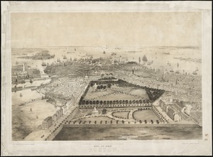
Bird's eye view of Boston
10.
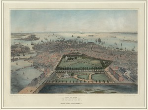
Bird's eye view of Boston
11.
[Mill dam survey : Boston, Roxbury, Brookline &c.]
12.
Boston Harbor
13.
Map of Boston Harbor : showing commissioners' lines, wharves &c
14.
Plan of Mystic River showing the Harbor Commissioners lines : Dec. 1854
15.
Plan of Neponset River and part of Dorchester Bay showing the harbor lines proposed by the Commissioners 1854
16.
Plan of South Bay showing the Harbor Commissioners lines
17.
Sketch of Boston Harbor and Bay
18.
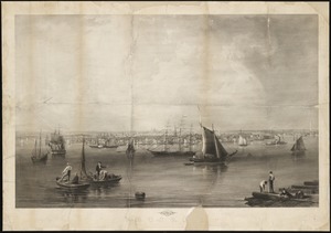
Boston
19.
Environs of Boston, from Corey's Hill, Brookline, Mass
20.
Outline key to Richardson's view of the environs of Boston from Corey's Hill, Brookline
‹ Prev
Next ›
1
2
3
4
5
…
26
27
![[Perspecti]ve view of the environs of [Bosto]n from Beacon Hill shewing the rebels [works?] & encampmentss, July 22d, 1775](https://bpldcassets.blob.core.windows.net/derivatives/metadata/commonwealth-oai:6d573t29z/image_thumbnail_300.jpg)