Toggle navigation
LMEC Home
Exhibitions
Georeferencing
Tools for Teachers
Collections
My Favorites
Sign Up / Log In
Search
Search the map portal
Map Collection
Map Collection
Map Sets
Search
Search
Search for
Search In
All Fields
Creator
Title
Subject
Place
Search All Digital Collections
Advanced Search
8720 Results
My Search
Start Over
More Like
commonwealth:2514p078d
Remove constraint More Like: commonwealth:2514p078d
Filter your Search
Place
North and Central America
5,927
United States
4,844
Massachusetts
2,079
Europe
1,396
Suffolk (county)
1,046
Boston
1,019
Canada
449
Asia
439
more
Place
»
Topic
Boston (Mass.)--Maps
586
United States--Maps
282
Real property--Massachusetts--Boston--Maps
175
Massachusetts--Maps
162
Landowners--Massachusetts--Boston--Maps
133
North America--Maps--Early works to 1800
104
New England--Maps
102
Europe--Maps
79
more
Topic
»
Date
Date range begin
–
Date range end
Current results range from
1482
to
2023
View distribution
Creator
United States. Hydrographic Office
595
O.H. Bailey & Co
148
Des Barres, Joseph F. W. (Joseph Frederick Wallet), 1722-1824
123
United States. Post Office Dept
120
Ptolemy, 2nd cent
100
Walling, Henry Francis, 1825-1888
94
Geological Survey (U.S.)
86
Jefferys, Thomas, -1771
86
more
Creator
»
Format
Maps/Atlases
8,660
Manuscripts
215
Prints
56
Books
36
Objects/Artifacts
10
Drawings/Illustrations
8
Posters
5
Georeferenced
Yes
869
No
7,851
Collection
Norman B. Leventhal Map & Education Center Collection
8,697
Boston and New England Maps
2,233
Urban Maps
2,023
Maritime Charts and Atlases
1,083
American Revolutionary War-Era Maps
629
Boston Redevelopment Authority Collection
87
Sidney R. Knafel Map Collection at Phillips Academy
10
MacLean Collection Map Library
6
more
Collection
»
Available to use
No known restrictions
8,552
Creative Commons license
57
Search Constraints
Sort by relevance
relevance
title
date (asc)
date (desc)
Number of results to display per page
20 per page
10
per page
20
per page
50
per page
100
per page
View results as:
grid view
map view
Search Results
3761.
Map of New England City, Dade County, Ga
3762.
Map of New England exhibiting the rail road & telegraphic lines now in operation
3763.
Map of New England exhibiting the rail road and telegraphic lines now in operation
3764.
Map of New England with adjacent portions of New York & Canada
3765.
Map of New England with adjacent portions of New York & Canada
3766.
Map of New England with adjacent portions of New York & Canada
3767.
Map of New Hampshire : compiled from the latest authorities
3768.
Map of New Milford, Litchfield Co., Conn
3769.
Map of New York and vicinity
3770.
Map of New York and vicinity
3771.
Map of New York City showing concrete socialism in red, and private enterprises in white, 1895
3772.
A map of New York which is published by the Washington Square Bookshop
3773.
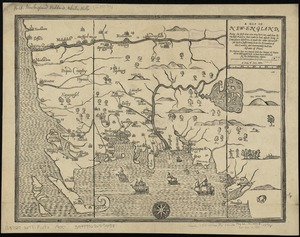
A map of New-England : being the first that ever was here cut, and done by the best pattern that could be had, which being in...
3774.
A map of New-England : being the first that ever was here cut, and done by the best pattern that could be had, which being in...
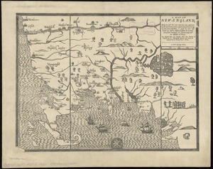
3775.
A map of New-England : being the first that ever was here cut, and done by the best pattern that could be had, which being in...
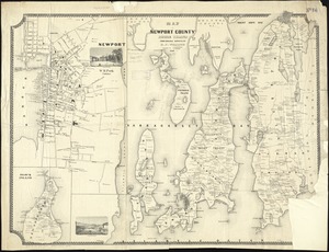
3776.
Map of Newport County, Rhode Island
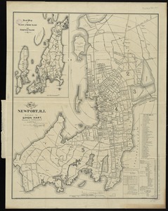
3777.
Map of Newport, R.I
3778.
Map of Newton Mass
3779.
Map of New-York
3780.
Map of New-York Bay and Harbor and the environs
‹ Prev
Next ›
1
2
…
185
186
187
188
189
190
191
192
193
…
435
436