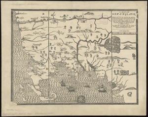
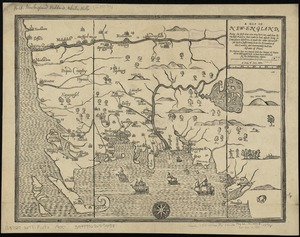
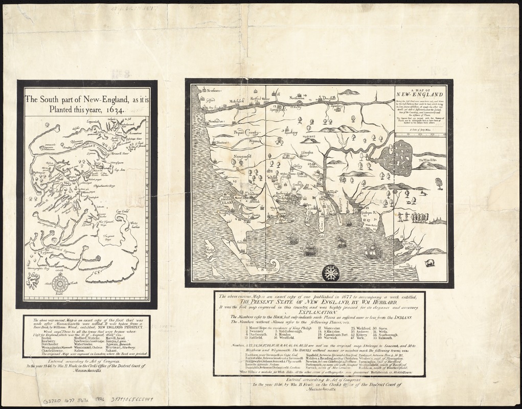
A map of New-England : being the first that ever was here cut, and done by the best pattern that could be had, which being in some places defective, it made the other less exact : yet doth it sufficiently shew the scituation of the country, and conveniently well the distance of places ; the figures that are joyned with the names of places are to distinguish such as have been assaulted by the Indian from others
Item Information
- Title:
- A map of New-England : being the first that ever was here cut, and done by the best pattern that could be had, which being in some places defective, it made the other less exact : yet doth it sufficiently shew the scituation of the country, and conveniently well the distance of places ; the figures that are joyned with the names of places are to distinguish such as have been assaulted by the Indian from others
- Title (alt.):
-
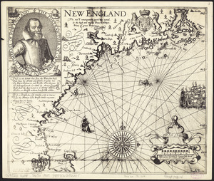
South part of New-England, as it is planted this yeare, 1634
- Creator:
- Foster, John, 1648-1681
- Creator:
- Wood, William, fl. 1629-1635
- Date:
-
1846
- Format:
-
Maps/Atlases
- Location:
-
Boston Public Library
Norman B. Leventhal Map & Education Center - Collection (local):
-
Norman B. Leventhal Map & Education Center Collection
- Subjects:
-
King Philip's War, 1675-1676
New England--Maps--Early works to 1800--Facsimiles
- Places:
-
New England (area)
- Extent:
- 2 maps on 1 sheet ; 26 x 18 cm. and 29 x 37 cm., on sheet 58 x 75 cm.
- Terms of Use:
-
No known copyright restrictions.
No known restrictions on use.
- Publisher:
-
Massachusetts :
Wm. B. Fowle
- Scale:
-
Scale [ca. 1:920,000]
Scale [ca. 1:1,150,000]
- Language:
-
English
- Notes:
-
Facsimiles of maps from Wood's New Englands prospect and Hubbard's Present state of New England.
Facsimile of Wine Hills version, state 2.
Relief shown pictorially.
Includes text and references.
- Identifier:
-
06_01_008620
- Call #:
-
G3720 1677 .F67x 1846
- Barcode:
-
39999065655449