Toggle navigation
LMEC Home
Exhibitions
Georeferencing
Tools for Teachers
Collections
My Favorites
Sign Up / Log In
Search
Search the map portal
Map Collection
Map Collection
Map Sets
Search
Search
Search for
Search In
All Fields
Creator
Title
Subject
Place
Search All Digital Collections
Advanced Search
8955 Results
My Search
Start Over
More Like
commonwealth:1257c4371
Remove constraint More Like: commonwealth:1257c4371
Filter your Search
Place
North and Central America
6,186
United States
5,102
Massachusetts
2,146
Europe
1,396
Suffolk (county)
1,301
Boston
1,274
Canada
449
Asia
438
more
Place
»
Topic
Boston (Mass.)--Maps
753
United States--Maps
282
Real property--Massachusetts--Boston--Maps
254
City planning--Massachusetts--Boston--Maps
218
Landowners--Massachusetts--Boston--Maps
170
Massachusetts--Maps
166
Urban renewal--Massachusetts--Boston--Maps
124
New England--Maps
104
more
Topic
»
Date
Date range begin
–
Date range end
Current results range from
1482
to
2023
View distribution
Creator
United States. Hydrographic Office
595
Boston Redevelopment Authority
222
O.H. Bailey & Co
148
Des Barres, Joseph F. W. (Joseph Frederick Wallet), 1722-1824
124
United States. Post Office Dept
120
Ptolemy, 2nd cent
100
Walling, Henry Francis, 1825-1888
94
Geological Survey (U.S.)
87
more
Creator
»
Format
Maps/Atlases
8,895
Manuscripts
215
Prints
56
Books
36
Objects/Artifacts
10
Drawings/Illustrations
8
Posters
5
Georeferenced
Yes
885
No
8,070
Collection
Norman B. Leventhal Map & Education Center Collection
8,726
Boston and New England Maps
2,425
Urban Maps
2,208
Maritime Charts and Atlases
1,083
American Revolutionary War-Era Maps
638
Boston Redevelopment Authority Collection
256
Massachusetts Real Estate Atlases
38
Mapping Boston Collection
20
more
Collection
»
Available to use
No known restrictions
8,732
Creative Commons license
70
Search Constraints
Sort by relevance
relevance
title
date (asc)
date (desc)
Number of results to display per page
20 per page
10
per page
20
per page
50
per page
100
per page
View results as:
grid view
map view
Search Results
6661.
Plan of New Orleans the capital of Louisiana : with the disposition of its quarters and canals as they have been traced by Mr....
6662.
Plan of New Orleans the capital of Louisiana : with the disposition of its quarters and canals as they have been traced by Mr....
6663.
Plan of New Orleans the capital of Louisiana
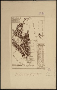
6664.
Plan of New York
6665.
A plan of New York Island, part of Long Island &c. shewing the position of the American and British Armies, before, at, and...
6666.
A plan of New York Island, with part of Long Island, Staten Island & east New Jersey, with a particular description of the...
6667.
A plan of New York Island, with part of Long Island, Staten Island & east New Jersey, with a particular description of the...
6668.
Plan of Newburyport Mass. from an actual survey
6669.
Plan of Newton & Needham
6670.
Plan of Newton Terraces, Newton, Mass
6671.
Plan of Oak Bluffs, Marthas Vineyard
6672.
Plan of Ocean View, Pigeon Cove, Mass
6673.
Plan of Orient Heights, Boston, Mass
6674.
Plan of part of Mystic River, with common low water mark of line of flats
6675.
Plan of part of the Sterling Branch R.R. from the plans of the Fitchburg R.R. shewing [sic] the line as chartered and the line...
6676.
A plan of Port Royal harbour in Carolina with the proposed forts, depth of water &c
6677.
A plan of Port Royal in South Carolina
6678.
Plan of portion of park system from Common to Franklin Park : including Charles River Basin, Charlesbank, Commonwealth Avenue,...
6679.
Plan of properties at Galloupe's Point : Swampscott, Mass.
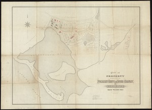
6680.
Plan of property belonging to the Pocasset Grove and Shore Company, at Cataumet, South Pocasset, Mass
‹ Prev
Next ›
1
2
…
330
331
332
333
334
335
336
337
338
…
447
448


![Plan of part of the Sterling Branch R.R. from the plans of the Fitchburg R.R. shewing [sic] the line as chartered and the line as located](https://bpldcassets.blob.core.windows.net/derivatives/images/commonwealth:x059cc86f/image_thumbnail_300.jpg)