Toggle navigation
LMEC Home
Exhibitions
Georeferencing
Tools for Teachers
Collections
My Favorites
Sign Up / Log In
Search
Search the map portal
Map Collection
Map Collection
Map Sets
Search
Search
Search for
Search In
All Fields
Creator
Title
Subject
Place
Search All Digital Collections
Advanced Search
8943 Results
My Search
Start Over
More Like
commonwealth:1257bt078
Remove constraint More Like: commonwealth:1257bt078
Filter your Search
Place
North and Central America
6,174
United States
5,090
Massachusetts
2,146
Europe
1,396
Suffolk (county)
1,289
Boston
1,262
Canada
449
Asia
438
more
Place
»
Topic
Boston (Mass.)--Maps
753
United States--Maps
282
Real property--Massachusetts--Boston--Maps
254
City planning--Massachusetts--Boston--Maps
207
Landowners--Massachusetts--Boston--Maps
170
Massachusetts--Maps
166
Urban renewal--Massachusetts--Boston--Maps
114
New England--Maps
104
more
Topic
»
Date
Date range begin
–
Date range end
Current results range from
1482
to
2023
View distribution
Creator
United States. Hydrographic Office
595
Boston Redevelopment Authority
212
O.H. Bailey & Co
148
Des Barres, Joseph F. W. (Joseph Frederick Wallet), 1722-1824
124
United States. Post Office Dept
120
Ptolemy, 2nd cent
100
Walling, Henry Francis, 1825-1888
94
Geological Survey (U.S.)
87
more
Creator
»
Format
Maps/Atlases
8,883
Manuscripts
215
Prints
56
Books
36
Objects/Artifacts
10
Drawings/Illustrations
8
Posters
5
Georeferenced
Yes
885
No
8,058
Collection
Norman B. Leventhal Map & Education Center Collection
8,726
Boston and New England Maps
2,413
Urban Maps
2,196
Maritime Charts and Atlases
1,083
American Revolutionary War-Era Maps
638
Boston Redevelopment Authority Collection
244
Massachusetts Real Estate Atlases
38
Mapping Boston Collection
20
more
Collection
»
Available to use
No known restrictions
8,720
Creative Commons license
70
Search Constraints
Sort by relevance
relevance
title
date (asc)
date (desc)
Number of results to display per page
20 per page
10
per page
20
per page
50
per page
100
per page
View results as:
grid view
map view
Search Results
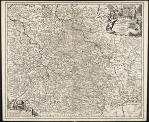
7361.
Regnum Bohemiae eique annexae provinciae ut Ducatus Silesiae, Marchionatus Moraviae et Lusatiae, vulgo die Erb-Länderen
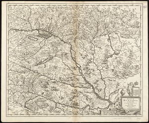
7362.
Regnum Hungaria in omnes suos comitatus accurate divisum et editum
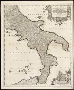
7363.
Regnum Neapolis : in quo sunt Aprutium ulterius et citerius, Comitatus Molisius, Terra Laboris, Capitaniata Principatus...
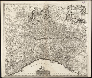
7364.
Reipublicae Genuensis et Ducatus Mediolanensis Parmensis et Montisferrati novissima descriptio
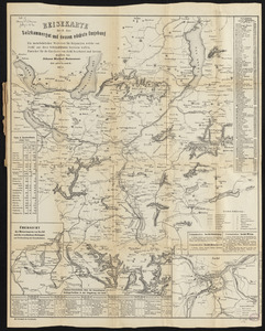
7365.
Reisekarte durch das Salzkammergut und dessen nächste umgebung : ein unentbehrlicher wegweiser für diejenigen, welche von...
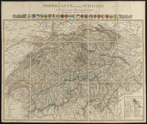
7366.
Reisekarte von der Schweiz nach den neuesten materialien berichtiget
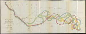
7367.
Relative positions of Rio Grande near El Paso between 1852 and 1907
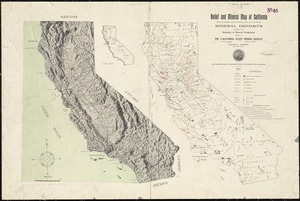
7368.
Relief and mineral map of California showing the topography and the approximate locations of all the principal mineral deposits...
7369.
Relief map of Canada and the United States
7370.
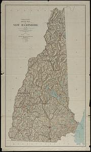
Relief map of New Hampshire
7371.
Relief map of New Jersey
7372.
Relief map of the Dominion of Canada
7373.
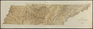
Relief map, state of Tennessee
7374.
Relief practice map
7375.
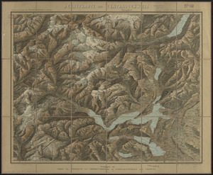
Reliefkarte der Centralschweiz
7376.
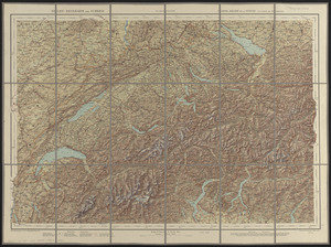
Relief-reisekarte der Schweiz = Carte-relief de la Suisse à l'usage des touristes
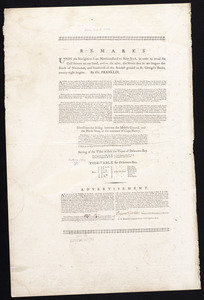
7377.
Remarks
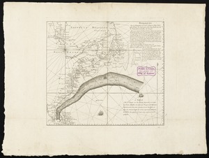
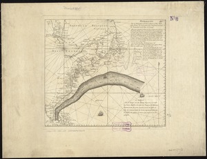
7378.
Remarques sur la navigation de terre-neuve à New-York afin d'eviter les courrants et les bas-fonds au sud de Nantuckett et du...
7379.
Remarques sur la navigation de terre-neuve à New-York afin d'eviter les courrants et les bas-fonds au sud de Nantuckett et du...
7380.
Repræsentatio accubitus regum Sueciæ Daniæ q: Fridericiburgi d. 3, 4 et 5 Mart. 1658
‹ Prev
Next ›
1
2
…
365
366
367
368
369
370
371
372
373
…
447
448