Toggle navigation
LMEC Home
Exhibitions
Georeferencing
Tools for Teachers
Collections
My Favorites
Sign Up / Log In
Search
Search the map portal
Map Collection
Map Collection
Map Sets
Search
Search
Search for
Search In
All Fields
Creator
Title
Subject
Place
Search All Digital Collections
Advanced Search
8934 Results
My Search
Start Over
More Like
commonwealth:0z7093608
Remove constraint More Like: commonwealth:0z7093608
Filter your Search
Place
North and Central America
6,165
United States
5,069
Massachusetts
2,204
Europe
1,396
Suffolk (county)
1,211
Boston
1,184
Canada
450
Asia
438
more
Place
»
Topic
Boston (Mass.)--Maps
752
United States--Maps
282
Massachusetts--Maps
235
Real property--Massachusetts--Boston--Maps
195
City planning--Massachusetts--Boston--Maps
159
Landowners--Massachusetts--Boston--Maps
142
New England--Maps
106
North America--Maps--Early works to 1800
103
more
Topic
»
Date
Date range begin
–
Date range end
Current results range from
1482
to
2023
View distribution
Creator
United States. Hydrographic Office
595
Boston Redevelopment Authority
164
O.H. Bailey & Co
148
Des Barres, Joseph F. W. (Joseph Frederick Wallet), 1722-1824
124
United States. Post Office Dept
120
Ptolemy, 2nd cent
100
Walling, Henry Francis, 1825-1888
95
Geological Survey (U.S.)
92
more
Creator
»
Format
Maps/Atlases
8,873
Manuscripts
217
Prints
56
Books
36
Objects/Artifacts
10
Drawings/Illustrations
8
Posters
5
Ephemera
1
Georeferenced
Yes
894
No
8,040
Collection
Norman B. Leventhal Map & Education Center Collection
8,765
Boston and New England Maps
2,405
Urban Maps
2,146
Maritime Charts and Atlases
1,083
American Revolutionary War-Era Maps
657
Boston Redevelopment Authority Collection
196
Mapping Boston Collection
22
Applied Geographics, Inc. Records
21
more
Collection
»
Available to use
No known restrictions
8,709
Creative Commons license
73
Search Constraints
Sort by relevance
relevance
title
date (asc)
date (desc)
Number of results to display per page
20 per page
10
per page
20
per page
50
per page
100
per page
View results as:
grid view
map view
Search Results
7341.
Recentissima novi orbis sive Americae septentrionalis et meridionalis tabula
7342.
Recentissima novi orbis, sive Americae Septentrionalis et Meridionalis tabula
7343.
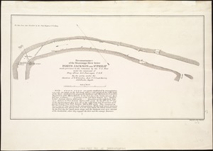
Reconnaissance of the battle field at Bull Run, Va., fought July 21, 1861
7344.
Reconnoissance of Cape Canaveral Shoals on the eastern coast of Florida
7345.
A reconnoissance of the Minnay Sotor Watapāh; or St. Peter's River to its sources : made in the year 1835
7346.
Reconnoissance of the Mississippi River below Forts Jackson and St. Philip : made previous to the reduction by the U.S. Fleet,...
7347.
Reconstruction Act, March 2, 1867, Vote on passage over President's veto
7348.
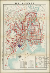
Reconstruction work in Tokyo
7349.
Los recursos de los Estados Unidos
7350.
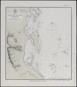
Red Sea, Safájah Island anchorages : from a British survey in 1872
7351.
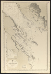
Red Sea, Strait of Jubal
7352.
Red Sea, Suez Bay : from British surveys in 1870, corrected to 1872
7353.
Reg Manning's table-top argu-map of the world
7354.
Region embraced in the operations of the armies against Richmond and Petersburg
7355.
Region embraced in the operations of the armies against Richmond and Petersburg
7356.
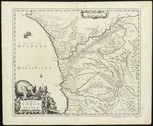
Regna Congo et Angola
7357.
Regni Hungariae, et regionum, quae ei quondam fuêre unitae, ut Transilvaniae, Valachiae, Moldaviae, Serviae, Romaniae,...
7358.
Regni Mexicani seu Novae Hispaniae, Ludovicianae, N. Angliae, Carolinae, Virginae et Pensylvaniae necnon insularum archipelagi...
7359.
Regni Navarrae accurata tabula
7360.
Regni Poloniae et Ducatus Lithuaniae, Voliniae, Podoliae, Ucraniae, Prussiae, Livoniae et Curlandiae descriptio
‹ Prev
Next ›
1
2
…
364
365
366
367
368
369
370
371
372
…
446
447


![Regni Hungariae, et regionum, quae ei quondam fuêre unitae, ut Transilvaniae, Valachiae, Moldaviae, Serviae, Romaniae, Bulgariae, Bessarabiae, Croatiae, Bosniae, Dalmatiae, Sclavoniae, Morlachiae, Ragusanae Reipublicae, maximaeq[ue] partis Danubii Fluminis, novissima delineatio](https://bpldcassets.blob.core.windows.net/derivatives/images/commonwealth:cj82ks70z/image_thumbnail_300.jpg)