Toggle navigation
LMEC Home
Exhibitions
Georeferencing
Tools for Teachers
Collections
My Favorites
Sign Up / Log In
Search
Search the map portal
Map Collection
Map Collection
Map Sets
Search
Search
Search for
Search In
All Fields
Creator
Title
Subject
Place
Search All Digital Collections
Advanced Search
8934 Results
My Search
Start Over
More Like
commonwealth:0z7093608
Remove constraint More Like: commonwealth:0z7093608
Filter your Search
Place
North and Central America
6,165
United States
5,069
Massachusetts
2,204
Europe
1,396
Suffolk (county)
1,211
Boston
1,184
Canada
450
Asia
438
more
Place
»
Topic
Boston (Mass.)--Maps
752
United States--Maps
282
Massachusetts--Maps
235
Real property--Massachusetts--Boston--Maps
195
City planning--Massachusetts--Boston--Maps
159
Landowners--Massachusetts--Boston--Maps
142
New England--Maps
106
North America--Maps--Early works to 1800
103
more
Topic
»
Date
Date range begin
–
Date range end
Current results range from
1482
to
2023
View distribution
Creator
United States. Hydrographic Office
595
Boston Redevelopment Authority
164
O.H. Bailey & Co
148
Des Barres, Joseph F. W. (Joseph Frederick Wallet), 1722-1824
124
United States. Post Office Dept
120
Ptolemy, 2nd cent
100
Walling, Henry Francis, 1825-1888
95
Geological Survey (U.S.)
92
more
Creator
»
Format
Maps/Atlases
8,873
Manuscripts
217
Prints
56
Books
36
Objects/Artifacts
10
Drawings/Illustrations
8
Posters
5
Ephemera
1
Georeferenced
Yes
894
No
8,040
Collection
Norman B. Leventhal Map & Education Center Collection
8,765
Boston and New England Maps
2,405
Urban Maps
2,146
Maritime Charts and Atlases
1,083
American Revolutionary War-Era Maps
657
Boston Redevelopment Authority Collection
196
Mapping Boston Collection
22
Applied Geographics, Inc. Records
21
more
Collection
»
Available to use
No known restrictions
8,709
Creative Commons license
73
Search Constraints
Sort by relevance
relevance
title
date (asc)
date (desc)
Number of results to display per page
20 per page
10
per page
20
per page
50
per page
100
per page
View results as:
grid view
map view
Search Results
6961.
Population of the world divided according to states
6962.
Port Amherst ... : Port Haldimand
6963.
Port Bonavista
6964.
Port Campbell
6965.
Port Chester, New York : 1882
6966.
Port Hood, situated on the north-western extremity of the island of Cape Breton
6967.
Port Hudson and its defences
6968.
Port Jackson
6969.
Port Mills : Port Mansfield ; Gambier Harbour
6970.
Port Mills : Port Mansfield ; Gambier Harbour
6971.
Port of Manchester
6972.
The port of Salem, Massachusetts
6973.
Port Orchard, Puget Sound, Washington Ter.
6974.
Port Royal appellé aujourd. par les Anglois Annapolis Royal
6975.
Port Royal in South Carolina : taken from surveys deposited at the Plantation Office
6976.
[Port Shediack and Cocagne]
6977.
Portage County, Wis.
6978.
Portage Lake and River with part of Keweenaw Bay
6979.
Portion of the copper district, Michigan, Lake Superior
6980.
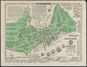
Portland also called Falmouth first settled 1632 chartered as a city 1832
‹ Prev
Next ›
1
2
…
345
346
347
348
349
350
351
352
353
…
446
447


![[Port Shediack and Cocagne]](https://bpldcassets.blob.core.windows.net/derivatives/images/commonwealth:ws859h35r/image_thumbnail_300.jpg)