Population of the world divided according to states
Item Information
- Title:
- Population of the world divided according to states
- Editor:
- Curtis, Lionel, 1872-1955
- Date:
-
1917
- Format:
-
Maps/Atlases
- Location:
-
Boston Public Library
Norman B. Leventhal Map & Education Center - Collection (local):
-
Norman B. Leventhal Map & Education Center Collection
- Subjects:
-
Population--Charts, diagrams, etc.
- Places:
-
World
- Extent:
- 1 diagram : color ; 21 x 40 cm, on sheet 24 x 58 cm
- Terms of Use:
-
No known copyright restrictions.
No known restrictions on use.
- Publisher:
-
London :
Macmillan and Co., Limited
- Language:
-
English
- Notes:
-
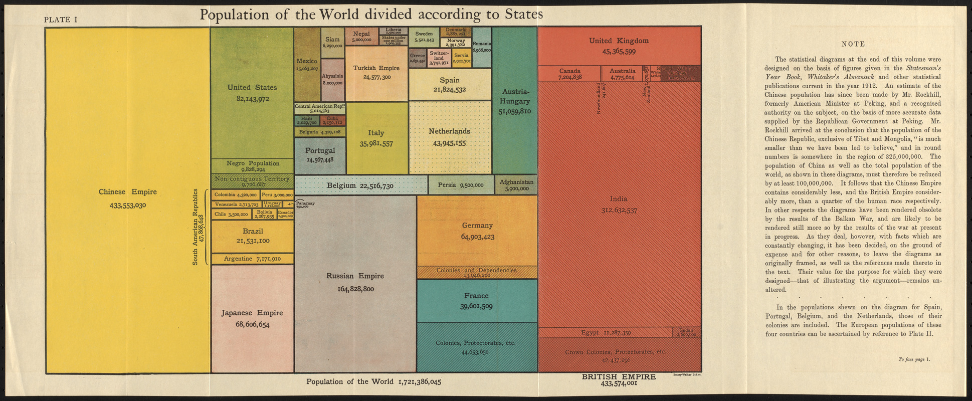
Square pie chart showing population of empires and countries.
Includes text.
Appears in The commonwealth of nations / edited by L. Curtis.
"Plate I."
"To face page I."
- Notes (exhibitions):
-
Exhibited: "Bending lines: maps and data from distortion to deception," organized by the Norman B. Leventhal Map & Education Center at the Boston Public Library, 2020-2021.
- Identifier:
-
06_01_017140
- Call #:
-
JN276 .C917
- Barcode:
-
39999085954236


