Toggle navigation
LMEC Home
Exhibitions
Georeferencing
Tools for Teachers
Collections
My Favorites
Sign Up / Log In
Search
Search the map portal
Map Collection
Map Collection
Map Sets
Search
Search
Search for
Search In
All Fields
Creator
Title
Subject
Place
Search All Digital Collections
Advanced Search
8830 Results
My Search
Start Over
More Like
commonwealth:0r96fq43n
Remove constraint More Like: commonwealth:0r96fq43n
Filter your Search
Place
North and Central America
6,041
United States
4,909
Massachusetts
2,079
Europe
1,397
Suffolk (county)
1,049
Boston
1,022
Canada
462
Asia
438
more
Place
»
Topic
Boston (Mass.)--Maps
586
United States--Maps
282
Real property--Massachusetts--Boston--Maps
175
Massachusetts--Maps
162
Manuscript maps--Early works to 1800
138
Landowners--Massachusetts--Boston--Maps
133
North America--Maps--Early works to 1800
105
New England--Maps
102
more
Topic
»
Date
Date range begin
–
Date range end
Current results range from
1482
to
2023
View distribution
Creator
United States. Hydrographic Office
595
O.H. Bailey & Co
148
Des Barres, Joseph F. W. (Joseph Frederick Wallet), 1722-1824
123
United States. Post Office Dept
120
Ptolemy, 2nd cent
100
Walling, Henry Francis, 1825-1888
94
Geological Survey (U.S.)
86
Jefferys, Thomas, -1771
85
more
Creator
»
Format
Maps/Atlases
8,770
Manuscripts
350
Prints
56
Books
36
Objects/Artifacts
10
Drawings/Illustrations
8
Posters
5
Georeferenced
Yes
871
No
7,959
Collection
Norman B. Leventhal Map & Education Center Collection
8,694
Boston and New England Maps
2,234
Urban Maps
2,030
Maritime Charts and Atlases
1,100
American Revolutionary War-Era Maps
748
Library of Congress Collection
97
Boston Redevelopment Authority Collection
87
Newberry Library Collection
39
Available to use
No known restrictions
8,552
Creative Commons license
144
Search Constraints
Sort by relevance
relevance
title
date (asc)
date (desc)
Number of results to display per page
20 per page
10
per page
20
per page
50
per page
100
per page
View results as:
grid view
map view
Search Results
7641.
South Framingham, Massachusetts : 1882
7642.
South Germany, (Bavaria, &c.)
7643.
South Italy
7644.
South Manchuria
7645.
South Mountain showing the positions of the forces of the United States and the enemy during the battle fought by the Army of...
7646.
South New Market : Rockingham County, N.H. 1884
7647.
South Norwalk and Norwalk, Conn : 1875
7648.
South Pacific
7649.
South Pacific, Fiji or Viti Group, Matuku ; Matuku Harbor
7650.
South Pacific, Fiji or Viti Group, Moala
7651.
South Pacific, Fiji or Viti Group, Nairai & Mbatiki Islands
7652.
South Pacific, Fiji or Viti Group, Ngau Island and Mumbolithe Reef
7653.
South Pacific, Fiji or Viti Group, Totoya
7654.
South Pacific, harbors in the Solomon Islands and in the neighboring groups : republication of Brit. Admty. chart no. 769
7655.
South Pacific, Juan Fernandez Id., Cumberland Bay : from a French survey in 1870
7656.
South Pacific Ocean
7657.
South Pacific Ocean, Caroline Island
7658.
South Pacific Ocean, Easter Island (Te Pito te Henua Island)
7659.
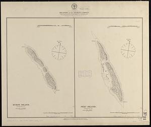
South Pacific Ocean, Islands in the Gilbert Group : from an examination by the U.S.S. "Narragansett", Comdr. R.W. Meade, in 1872
7660.
South Pacific Ocean, Paumotu Group - Rairoa (Rangiroa) Island, Avatoru Pass and anchorage
‹ Prev
Next ›
1
2
…
379
380
381
382
383
384
385
386
387
…
441
442