Toggle navigation
LMEC Home
Exhibitions
Georeferencing
Tools for Teachers
Collections
My Favorites
Sign Up / Log In
Search
Search the map portal
Map Collection
Map Collection
Map Sets
Search
Search
Search for
Search In
All Fields
Creator
Title
Subject
Place
Search All Digital Collections
Advanced Search
4844 Results
My Search
Start Over
More Like
commonwealth:7h14b2398
Remove constraint More Like: commonwealth:7h14b2398
Place
United States
Remove constraint Place: United States
Filter your Search
Place
North and Central America
4,844
United States
[remove]
4,844
Massachusetts
2,079
Suffolk (county)
1,045
Boston
1,018
New York
277
Middlesex (county)
220
New England
188
more
Place
»
Topic
Boston (Mass.)--Maps
585
United States--Maps
278
Real property--Massachusetts--Boston--Maps
175
Massachusetts--Maps
162
Landowners--Massachusetts--Boston--Maps
133
New England--Maps
102
City planning--Massachusetts--Boston--Maps
67
Manuscript maps
56
more
Topic
»
Date
Date range begin
–
Date range end
Current results range from
1548
to
2023
1548 : 2024
1548
2024
View distribution
Creator
O.H. Bailey & Co
144
United States. Post Office Dept
119
Walling, Henry Francis, 1825-1888
90
Geological Survey (U.S.)
84
Wright, John Kirtland, 1891-1969
71
Boston Redevelopment Authority
70
Paullin, Charles Oscar, 1868 or 1869-1944
70
Geo. H. Walker & Co
63
more
Creator
»
Format
Maps/Atlases
4,827
Manuscripts
179
Books
34
Prints
17
Drawings/Illustrations
7
Objects/Artifacts
5
Posters
3
Georeferenced
Yes
637
No
4,207
Collection
Norman B. Leventhal Map & Education Center Collection
4,843
Boston and New England Maps
2,229
Urban Maps
1,785
American Revolutionary War-Era Maps
352
Maritime Charts and Atlases
216
Boston Redevelopment Authority Collection
87
William L. Clements Library Collection
1
Available to use
No known restrictions
4,729
Creative Commons license
39
Search Constraints
Sort by relevance
relevance
title
date (asc)
date (desc)
Number of results to display per page
20 per page
10
per page
20
per page
50
per page
100
per page
View results as:
grid view
map view
Search Results
1.
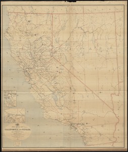
Map of California and Nevada
2.
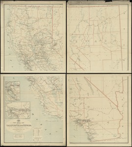
Map of California and Nevada, with parts of Utah & Arizona
3.
Post route map of the states of California and Nevada showing post offices with the intermediate distances on mail routes in...
4.
Post route map of the states of California and Nevada with adjacent parts of Oregon, Idaho, Utah, Arizona and of the Republic...
5.
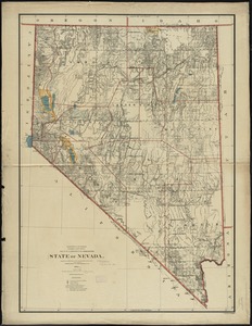
State of Nevada
6.
Fault map of the state of California
7.
Geographical, topographical, state highway and railroad map of California
8.
Map of North America
9.
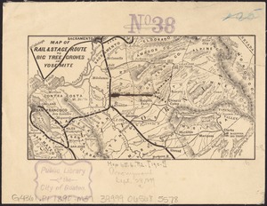
Map of rail & stage route to Big Tree Groves and Yosemite
10.
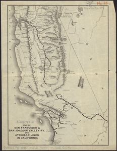
Map of San Francisco & San Joaquin Valley Ry. and Atchison lines in California
11.
Rand, McNally & Co.'s California
12.
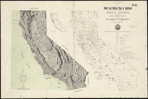
Relief and mineral map of California showing the topography and the approximate locations of all the principal mineral deposits...
13.
State of California
14.
The unique map of California
15.
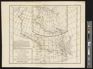
Carte de la Californie et des pays nord-ouest separés de l'Asie par le détroit d'Anian, extraite de deux cartes publiées au...
16.
The 100th anniversary map of Abraham Lincoln's visit to Massachusetts, September 11-23, 1848
17.
1630 shoreline
18.
1879. Progress map of the U.S. Geographical Surveys west of the 100th Meridian : prepared under the direction of 1st Lieut....
19.
1903 Map of Salem and surrounding places
20.
19th annual convention of the National Association of Real Estate Boards : at Tulsa, June 7 to June 11 in 1926
+
-
Redo search here
Search when I move the map
Leaflet
| ©
OpenStreetMap
contributors, ©
CartoDB
‹ Prev
Next ›
1
2
3
4
5
…
242
243