Toggle navigation
LMEC Home
Exhibitions
Georeferencing
Tools for Teachers
Collections
My Favorites
Sign Up / Log In
Search
Search the map portal
Map Collection
Map Collection
Map Sets
Search
Search
Search for
Search In
All Fields
Creator
Title
Subject
Place
Search All Digital Collections
Advanced Search
423 Results
My Search
Start Over
More Like
commonwealth:q524nj54q
Remove constraint More Like: commonwealth:q524nj54q
Place
North and Central America
Remove constraint Place: North and Central America
Filter your Search
Place
North and Central America
[remove]
423
United States
296
New York
40
Florida
19
Alabama
15
Canada
15
Chatham (county)
15
Savannah
13
more
Place
»
Topic
Manuscript maps--Early works to 1800
75
Manuscript maps
21
Fortification--New York (State)--New York--Maps--Early works to 1800
11
Gulf Coast (U.S.)--Maps, Manuscript--Early works to 1800
11
New York (N.Y.)--Buildings, structures, etc--Maps, Manuscript--Early works to 1800
9
New York (N.Y.)--Maps, Manuscript--Early works to 1800
8
Saratoga Campaign, N.Y., 1777--Maps, Manuscript--Early works to 1800
8
Coasts--Florida--Maps--Early works to 1800
7
more
Topic
»
Date
Date range begin
–
Date range end
Current results range from
1750
to
1899
1750 : 1900
1750
1900
View distribution
Creator
Hills, John, (Surveyor)
18
Montrésor, John, 1736-1799
16
Bingham, William, 1752-1804
11
Adlum, John, 1759-1836
9
Washington, George, 1732-1799
9
Faden, William, 1749-1836
7
Morgan, Benjamin, (Draftsman)
7
Wangenheim, Friedrich Adam Julius von
7
more
Creator
»
Format
Maps/Atlases
421
Manuscripts
419
Objects/Artifacts
2
Georeferenced
Yes
4
No
419
Collection
American Revolutionary War-Era Maps
423
Library of Congress Collection
419
Maritime Charts and Atlases
28
Urban Maps
13
British Library Collection
4
Available to use
Creative Commons license
423
Search Constraints
Sort by relevance
relevance
title
date (asc)
date (desc)
Number of results to display per page
20 per page
10
per page
20
per page
50
per page
100
per page
View results as:
grid view
map view
Search Results
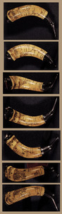
1.
Powder horn with hand-drawn map of the Hudson River (above Albany), Mohawk River, Niagara region, and Lake Ontario in New York...
2.
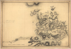
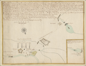
[A colored map of the route between Albany and Oswego; drawn about 1756, on a scale of 2 miles to an inch]
3.
The Course of the Wood Creek from the Mowhock River at the Onoida or Great Carrying Place to The Onoida Lake. Representing the...
4.
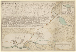
PLAN of the FORTS at the Onoida or Great Carrying Place in the Province of New York in America built by Major Charles Craven by...
5.
Plan of the Forts at the Onoida or Great Carrying Place in the Province of New York in North America built by Major Charles...
6.
1st. & 2d. position of that part of the army engaged on the 19th Sept. 1777 : 3d & 4th postn. Sept. 19
7.
20 tracts, Charleston
8.
20 tracts, Tioga County
9.
The Above is a plan of the town of Cabot, State of Vermont
10.
The above plan is a discription of a new township containing the quantity of seven and a half mile of land & water, granted by...
11.
An accurate map of His Majesty's Province of New-Hampshire in New England & all the adjacent country northward to the River St....
12.
Amboy to Elizabethtown
13.
Armée de Rochambeau, 1782 : Carte des environs de Williamsburg en Virginie où les armées françoise et américaine ont...
14.
Armstrong County
15.
Armstrong C[ount]y
16.
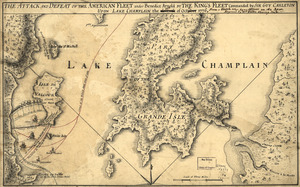
The Attack and defeat of the American fleet under Benedict Arnold : by the King's fleet commanded by Sir Guy Carleton upon Lake...
17.
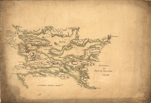
Attacks upon Rhode Island, Augt. 1778
18.
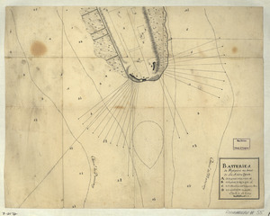
Batteries de West-point au haut de la Rivière d'York
19.
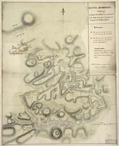
Battle of Brandywine : 11th Septr. 1777, in which the rebels were defeated by the army under the command of General Sir William...
20.
Battle of Brandywine, 11 Septr. 1777
+
-
Redo search here
Search when I move the map
Leaflet
| ©
OpenStreetMap
contributors, ©
CartoDB
‹ Prev
Next ›
1
2
3
4
5
…
21
22
![[A colored map of the route between Albany and Oswego; drawn about 1756, on a scale of 2 miles to an inch]](https://bpldcassets.blob.core.windows.net/derivatives/images/commonwealth:hx11z3223/image_thumbnail_300.jpg)


![Armstrong C[ount]y](https://bpldcassets.blob.core.windows.net/derivatives/images/commonwealth:q524ng353/image_thumbnail_300.jpg)