Toggle navigation
LMEC Home
Exhibitions
Georeferencing
Tools for Teachers
Collections
My Favorites
Sign Up / Log In
Search
Search the map portal
Map Collection
Map Collection
Map Sets
Search
Search
Search for
Search In
All Fields
Creator
Title
Subject
Place
Search All Digital Collections
Advanced Search
5930 Results
My Search
Start Over
More Like
commonwealth:4m90fp736
Remove constraint More Like: commonwealth:4m90fp736
Place
North and Central America
Remove constraint Place: North and Central America
Filter your Search
Place
North and Central America
[remove]
5,930
United States
4,848
Massachusetts
2,079
Suffolk (county)
1,045
Boston
1,018
Canada
449
New York
277
North America
233
more
Place
»
Topic
Boston (Mass.)--Maps
585
United States--Maps
281
Real property--Massachusetts--Boston--Maps
175
Massachusetts--Maps
162
Landowners--Massachusetts--Boston--Maps
133
North America--Maps--Early works to 1800
103
New England--Maps
102
City planning--Massachusetts--Boston--Maps
67
more
Topic
»
Date
Date range begin
–
Date range end
Current results range from
1525
to
2023
1525 : 2024
1525
2024
View distribution
Creator
United States. Hydrographic Office
283
O.H. Bailey & Co
146
United States. Post Office Dept
120
Des Barres, Joseph F. W. (Joseph Frederick Wallet), 1722-1824
114
Walling, Henry Francis, 1825-1888
93
Geological Survey (U.S.)
86
Wright, John Kirtland, 1891-1969
71
Boston Redevelopment Authority
70
more
Creator
»
Format
Maps/Atlases
5,912
Manuscripts
185
Books
34
Prints
18
Drawings/Illustrations
7
Objects/Artifacts
5
Posters
3
Georeferenced
Yes
698
No
5,232
Collection
Norman B. Leventhal Map & Education Center Collection
5,925
Boston and New England Maps
2,230
Urban Maps
1,827
Maritime Charts and Atlases
624
American Revolutionary War-Era Maps
570
Boston Redevelopment Authority Collection
87
William L. Clements Library Collection
2
Library of Congress Collection
1
more
Collection
»
Available to use
No known restrictions
5,810
Creative Commons license
42
Search Constraints
Sort by relevance
relevance
title
date (asc)
date (desc)
Number of results to display per page
20 per page
10
per page
20
per page
50
per page
100
per page
View results as:
grid view
map view
Search Results
1.
Colton's Georgetown and the city of Washington : the capital of the United States of America ; Colton's map showing part of...
2.
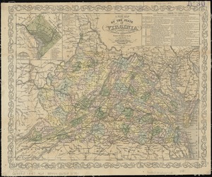
Map of Virginia and Maryland, constructed from the latest authorities
3.
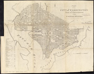
Plan of the city of Washington, in the territory of Columbia, ceded by the States of Virginia and Maryland to the United States...
4.
Carte générale des États-Unis de l'Amérique avec les plans des principales villes
5.
Delaware and Maryland
6.
E. & G.W. Blunt's corrected map of Washington and the seat of war on the Potomac
7.
Map of n. eastern Virginia and vicinity of Washington
8.
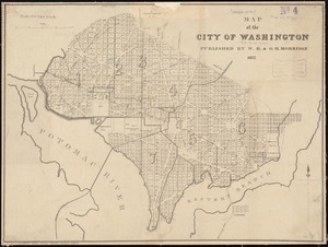
Map of the city of Washington
9.
Map of the city of Washington in the District of Columbia shewing the architectvre and history from the most ancient times down...
10.
Map of the seat of war : containing a map of the vicinity of Washington, Baltimore, Harper's Ferry and Annapolis, with five...
11.
Map of Washington
12.
Map of Washington ; map of Cincinnati
13.
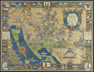
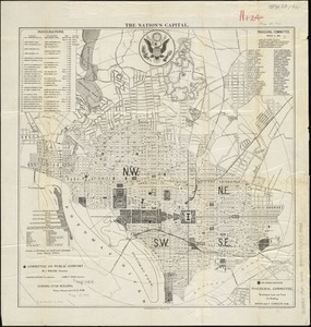
The nation's capital : [Washington D.C.]
14.
New bond paper map of the city of Washington
15.
A new map of the state of Virginia : exhibiting its internal improvements, roads, distances, &c
16.
Plan of the city of Washington, seat of government of the United States
17.
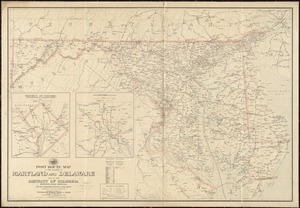
Post route map of the states of Maryland and Delaware and of the District of Columbia showing post offices with the...
18.
Post route map of the states of Pennsylvania, New Jersey, Delaware, and Maryland and of the District of Columbia with adjacent...
19.
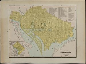
Rand, McNally & Co.'s indexed atlas of the world : map of Washington, D.C
20.
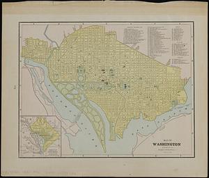
Rand McNally standard map of Washington D.C.
+
-
Redo search here
Search when I move the map
Leaflet
| ©
OpenStreetMap
contributors, ©
CartoDB
‹ Prev
Next ›
1
2
3
4
5
…
296
297