Toggle navigation
LMEC Home
Exhibitions
Georeferencing
Tools for Teachers
Collections
My Favorites
Sign Up / Log In
Search
Search the map portal
Map Collection
Map Collection
Map Sets
Search
Search
Search for
Search In
All Fields
Creator
Title
Subject
Place
Search All Digital Collections
Advanced Search
44 Results
My Search
Start Over
More Like
commonwealth:d7920269f
Remove constraint More Like: commonwealth:d7920269f
Topic
United States--Maps--Early works to 1800
Remove constraint Topic: United States--Maps--Early works to 1800
Filter your Search
Place
United States
44
North and Central America
43
Canada
14
Great Lakes Region
1
Saint Lawrence River
1
Topic
United States--Maps--Early works to 1800
[remove]
44
Canada--Maps--Early works to 1800
14
Indians of North America--United States--Maps
2
Great Lakes Region (North America)--Maps--Early works to 1800
1
Indians of North America--United States--Maps--Early works to 1800
1
Real property--United States--Maps
1
Saint Lawrence River--Maps--Early works to 1800
1
United States--History--Revolution, 1775-1783--Maps
1
Date
Date range begin
–
Date range end
Current results range from
1755
to
1805
1755 : 1806
1755
1806
View distribution
Creator
Stockdale, John, 1749?-1814
4
Anville, Jean Baptiste Bourguignon d', 1697-1782
3
Carey, Mathew, 1760-1839
2
Faden, William, 1749-1836
2
Jefferys, Thomas, -1771
2
Kitchin, Thomas, 1719-1784
2
Morse, Jedidiah, 1761-1826
2
Robert de Vaugondy, Didier, 1723-1786
2
more
Creator
»
Format
Maps/Atlases
44
Georeferenced
Yes
1
No
43
Collection
American Revolutionary War-Era Maps
44
MacLean Collection Map Library
43
New York Public Library Collection
1
Available to use
Creative Commons license
1
Search Constraints
Sort by relevance
relevance
title
date (asc)
date (desc)
Number of results to display per page
20 per page
10
per page
20
per page
50
per page
100
per page
View results as:
grid view
map view
Search Results
1.
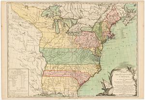
An accurate map of the United States of America : according to the Treaty of Peace of 1783
2.
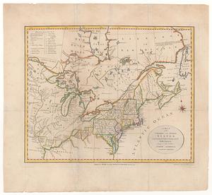
America
3.
British dominions in America agreeable to the treaty of 1763 : divided into the several provinces, and jurisdictions
4.
Canada Louisiane et terres angloises
5.
Canada Louisiane et terres angloises
6.
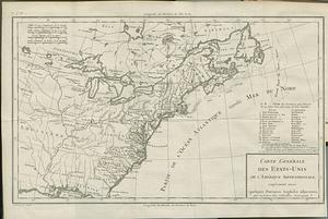
Carte des Etats-Unis d'Amérique, et du cours du Mississipi : redigée d'après différentes cartes et relations anglaises, et les...
7.
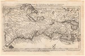
Carte des possessions des anglois en Amerique, par rapport à leurs differends avec la France
8.
Carte des pretentions des anglois dans l'Amerique Septentrionale suivant leurs chartres tant sur les possessions de la France...
9.
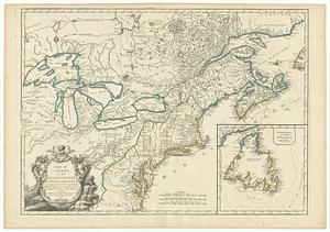
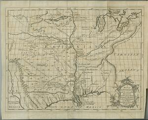
Carte du Canada et de la Louisiane qui forment la Nouvelle France et des colonies angloises ou sont representez les pays...
10.
Carte du Canada et des Etats-Unis de l'Amerique Septentrionale
11.
Carte générale des Etats-Unis de l'Amerique Septentrionale, renfermant aussi quelques provinces angloises adjacentes, pour les...
12.
Carte generale des treize Etats-Unis & independants de l'Amerique Septentrionale pour servir au spectateur Americain
13.
Carte nouvelle de l'Amerique angloise contenant tout ce que les anglois possedent sur le continent de l'Amerique Septentrionale...
14.
Etats-Unis de l'Amérique Septentrionale avec les Isles Royale, de Terre Neuve, de S.t Jean, l'Acadie, &c.
15.
Karte von Luisiana, dem laufe des Mississipi und den benachbaerten laendern
16.
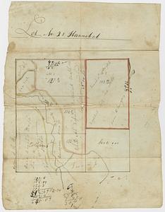
Lot no. 21 Hannibal
17.
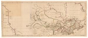
A map of Canada and the north part of Louisiana with the adjacent countrys
18.
A map of Louisiana with the course of the Missisipi, and the adjacent rivers, the nations of the natives, the French...
19.
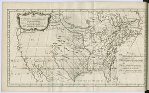
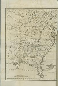
A map of the American Indian nations, adjoining to the Missisippi, west & east Florida, Georgia, S. & N. Carolina, Virginia, &c.
20.
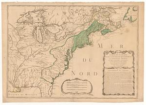
A map of the northern and middle states : comprehending the western territory and the British dominions in North America, from...
‹ Prev
Next ›
1
2
3