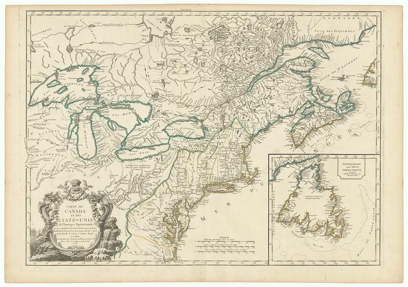
Carte du Canada et des Etats-Unis de l'Amerique Septentrionale
This map is also available in American Revolutionary Geographies Online (ARGO), a collections portal especially built for material relating to the American Revolutionary War Era. Visit ARGO to learn more about this item and explore the historical geography of North America in the late eighteenth century.
Item Information
- Title:
- Carte du Canada et des Etats-Unis de l'Amerique Septentrionale
- Cartographer:
- Robert de Vaugondy, Didier, 1723-1786
- Publisher:
- Fortin, J. (Jean), 1740-1817
- Name on Item:
-
par le sr. Robert de Vaugondy geog. Ord, du roi du feu roi de Pologne Duc de Lorraine et de Bar, de la Societe Royale de Nancy et Censeur Royal
- Date:
-
1778
- Format:
-
Maps/Atlases
- Location:
- MacLean Collection Map Library
- Collection (local):
-
MacLean Collection Map Library
- Subjects:
-
Canada--Maps--Early works to 1800
United States--Maps--Early works to 1800
- Places:
-
United States
Canada
- Extent:
- 1 map ; 534 x 762 mm
- Terms of Use:
-
Public Domain/No known restrictions on use. Contact host institution to download image.
Contact host institution for more information.
- Publisher:
-
Paris :
Chez Fortin Ingr. Mécanicien du roi pour les globes et spheres ; rue de la Harpe pres celle du Foin
- Language:
-
French
- Identifier:
-
MC_33729
- Call #:
-
33729


