Toggle navigation
LMEC Home
Exhibitions
Georeferencing
Tools for Teachers
Collections
My Favorites
Sign Up / Log In
Search
Search the map portal
Map Collection
Map Collection
Map Sets
Search
Search
Search for
Search In
All Fields
Creator
Title
Subject
Place
Search All Digital Collections
Advanced Search
871 Results
My Search
Start Over
More Like
commonwealth:cj82kn57k
Remove constraint More Like: commonwealth:cj82kn57k
Georeferenced
Yes
Remove constraint Georeferenced: Yes
Filter your Search
Place
North and Central America
700
United States
639
Massachusetts
247
Suffolk (county)
123
Boston
116
Europe
80
Asia
38
New York
28
more
Place
»
Topic
Boston (Mass.)--Maps
80
United States--Maps
65
Massachusetts--Maps
55
Virginia--Maps
20
Mexico--Maps
18
New England--Maps
17
Europe--Maps
14
Immigrants--Massachusetts--Boston--Maps
13
more
Topic
»
Date
Date range begin
–
Date range end
Current results range from
1609
to
2017
1609 : 2018
1609
2018
View distribution
Creator
United States. General Land Office
49
United States. Post Office Dept
49
Paullin, Charles Oscar, 1868 or 1869-1944
23
Wright, John Kirtland, 1891-1969
23
Rand McNally and Company
17
Geological Survey (U.S.)
15
Geo. H. Walker & Co
13
United States. Central Intelligence Agency
11
more
Creator
»
Format
Maps/Atlases
871
Manuscripts
15
Georeferenced
Yes
[remove]
871
Collection
Norman B. Leventhal Map & Education Center Collection
871
Boston and New England Maps
209
Urban Maps
171
American Revolutionary War-Era Maps
35
Maritime Charts and Atlases
10
Mapping Boston Collection
1
Available to use
No known restrictions
837
Creative Commons license
8
Search Constraints
Sort by relevance
relevance
title
date (asc)
date (desc)
Number of results to display per page
20 per page
10
per page
20
per page
50
per page
100
per page
View results as:
grid view
map view
Search Results
1.
Complete map of the rail roads and water courses in the United States & Canada
2.
Diagram of the United States of America, Mexico, the West India Islands and Isthmus of Darien : showing proposed routes of the...
3.
General railway map engraved expressly for the Official guide of the railways and steam navigation lines of the United States,...
4.
Lloyd's American railroad map
5.
Map of the public land states and territories : constructed from the Public Surveys and other official sources in the General...
6.
Rock Island-Frisco lines and Chicago & Eastern Illinois R.R : traverse the richest and most prosperous commonwealths in the Union
7.
The southwestern railroad system United States and Mexico
8.
Trans-continental map : showing the main lines and proposed extensions of the various trans-continental railroad systems of the...
9.
Colton's new railroad & county map of the United States, the Canadas &c
10.
Abolition of Slavery, 1863
11.
Colton's map of the United States of America, the British provinces, Mexico and the West Indies : showing the country from the...
12.
Compromise of 1850, September 6, 1850, vote on passage of Texas-New Mexico provisions
13.
Electoral vote for President, 1789
14.
Electoral vote for President, 1792
15.
Electoral vote for President, 1796
16.
An improved map of the United States
17.
Kansas-Nebraska Act, May 22, 1854, Vote on passage
18.
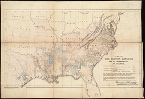
A map of the cotton kingdom and its dependencies in America
19.
Map of the United States
20.
Map of the United States : intending chiefly to exhibit the post roads & distances
‹ Prev
Next ›
1
2
3
4
5
…
43
44