Toggle navigation
LMEC Home
Exhibitions
Georeferencing
Tools for Teachers
Collections
My Favorites
Sign Up / Log In
Search
Search the map portal
Map Collection
Map Collection
Map Sets
Search
Search
Search for
Search In
All Fields
Creator
Title
Subject
Place
Search All Digital Collections
Advanced Search
14164 Results
Filter your Search
Place
North and Central America
10,832
United States
8,868
Massachusetts
2,832
Suffolk (county)
1,688
Boston
1,644
Europe
1,428
Canada
1,010
New York
684
more
Place
»
Topic
Boston (Mass.)--Maps
753
City planning--Massachusetts--Boston--Maps
419
United States--History--Revolution, 1775-1783--Maps
331
United States--Maps
331
Real property--Massachusetts--Boston--Maps
254
Urban renewal--Massachusetts--Boston--Maps
254
North America--Maps--Early works to 1800
241
Massachusetts--Maps
236
more
Topic
»
Date
Date range begin
–
Date range end
Current results range from
1482
to
2023
View distribution
Creator
United States. Hydrographic Office
597
Boston Redevelopment Authority
404
Des Barres, Joseph F. W. (Joseph Frederick Wallet), 1722-1824
247
Jefferys, Thomas, -1771
172
United States. National Ocean Service
170
Royal United Services Institute for Defence and Security Studies
160
George, III, King of Great Britain, 1738-1820
152
George, IV, King of Great Britain, 1762-1830
151
more
Creator
»
Format
Maps/Atlases
13,978
Manuscripts
985
Prints
102
Books
53
Drawings/Illustrations
44
Photographs
15
Objects/Artifacts
13
Documents
7
more
Format
»
Georeferenced
Yes
979
No
13,185
Collection
Norman B. Leventhal Map & Education Center Collection
9,162
American Revolutionary War-Era Maps
3,629
Boston and New England Maps
2,936
Urban Maps
2,511
Maritime Charts and Atlases
1,169
William L. Clements Library Collection
910
Library of Congress Collection
618
Boston Redevelopment Authority Collection
475
more
Collection
»
Available to use
No known restrictions
10,408
Creative Commons license
1,678
Search Constraints
Sort by relevance
relevance
title
date (asc)
date (desc)
Number of results to display per page
20 per page
10
per page
20
per page
50
per page
100
per page
View results as:
grid view
map view
Search Results
12101.
Siege of Charleston, South Carolina 1780
12102.
Siege of Charlestown 1780
12103.
The siege of Colberg, from 3d. to 31st. October, 1758
12104.
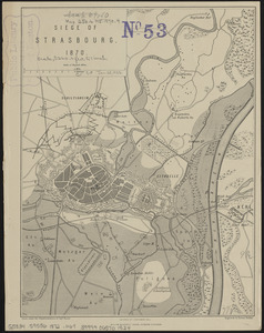
Siege of Strasbourg, 1870
12105.
Siege of Strasbourg, 1870 : enlarged sketch of works
12106.
Siege of Vera Cruz, by the U.S. troops under Major General Scott, in March 1847, from surveys made by Major Turnbull, Captains...
12107.
Siege of Yorktown
12108.
Siege operations at Spanish Fort, Mobile Bay : by the U.S. forces under Maj. Gen. Canby. Captured by the Army of West Miss. on...
12109.
Simoda Harbor, I. of Nippon
12110.
S[i]r: This is minuts of the fort at Crown Point and of the redouts built round it; which I took on the mountain to the west of...
12111.
Siskiyou National Forest, Oregon and California
12112.
Site preparation contract for the reconstruction of Copley Square Park, City of Boston, Massachusetts : contract documents
12113.
Site preparation contract tree planting - various locations
12114.
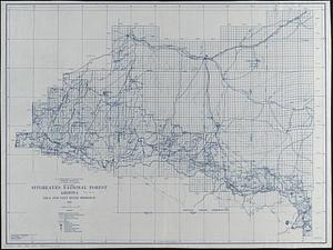
Sitgreaves National Forest, Arizona
12115.
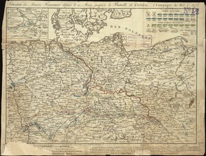
Situation des armées Françaises depuis le 10 mars jusqu'à la bataille de Wurtchen : (Campagne de 1813)
12116.
Situation des posten zu Denyses Ferry auf Long Island wie solcher den 7ten October 1781 von furste : Braunshweig und Hessen...
12117.
Situation of ye rebels just before the attack upon Trenton
12118.
Situations plan der Englischen Armée vor und um Boston nebst der stellung der Americaner
12119.
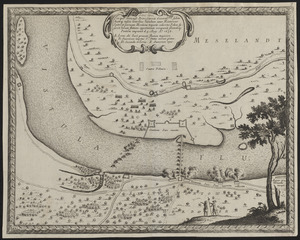
Situs loci in quo Sereniss. Princ. Sueciae General. mus. subito hoste q. inscio lintribus Vistulam inter Montower Spitz et...
12120.
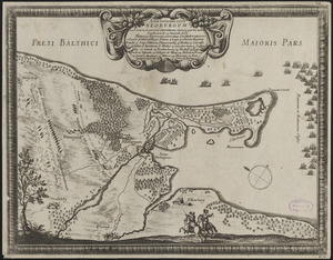
Situs locorum circa Neoburgum in Fionia, et positus exercituum vtriusq: partis, ante conflictum, d. 14. Nouemb. 1659
‹ Prev
Next ›
1
2
…
602
603
604
605
606
607
608
609
610
…
708
709


![S[i]r: This is minuts of the fort at Crown Point and of the redouts built round it; which I took on the mountain to the west of Crown Point abt. a miles distance](https://bpldcassets.blob.core.windows.net/derivatives/images/commonwealth:q524nd85w/image_thumbnail_300.jpg)