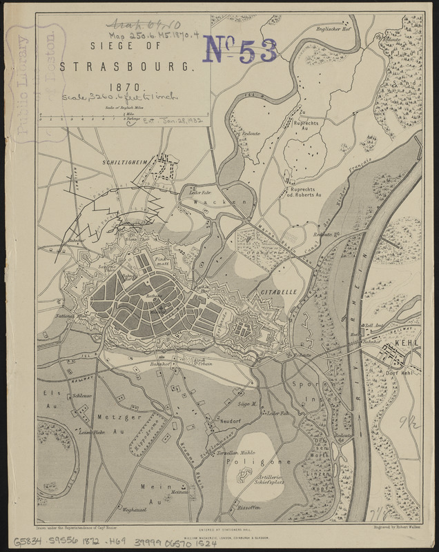
Siege of Strasbourg, 1870
Item Information
- Title:
- Siege of Strasbourg, 1870
- Cartographer:
- Hozier, H. M. (Henry Montague), 1842-1907
- Engraver:
- Walker, Robert
- Publisher:
- Mackenzie, William (Publisher)
- Name on Item:
-
drawn under the superintendence of Captain Hozier ; engraved by Robert Walker
- Date:
-
[1872]
- Format:
-
Maps/Atlases
- Location:
-
Boston Public Library
Norman B. Leventhal Map & Education Center - Collection (local):
-
Norman B. Leventhal Map & Education Center Collection
- Subjects:
-
Franco-Prussian War, 1870-1871
Strasbourg (France)--History--Siege, 1870--Maps
- Places:
-
FranceGrand Est (region)Strasbourg
- Extent:
- 1 map ; 25 x 19 cm
- Terms of Use:
-
No known copyright restrictions.
No known restrictions on use.
- Publisher:
-
London :
William Mackenzie
- Scale:
-
Scale approximately 1:40,000
- Language:
-
English
- Notes:
-
From Hozier's The Franco-Prussian War: its causes, incidents, and consequences. London : W. Mackenzie, [1872].
- Notes (date):
-
This date is inferred.
- Identifier:
-
06_01_014362
- Call #:
-
G5834.S9S56 1872 .H69
- Barcode:
-
39999065701524


