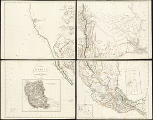
Siege of Vera Cruz, by the U.S. troops under Major General Scott, in March 1847, from surveys made by Major Turnbull, Captains Hughes, McClellan, & Johnston; Lieutenants Derby & Hardcastle, Topl. Engineers

Item Information
- Title:
- Siege of Vera Cruz, by the U.S. troops under Major General Scott, in March 1847, from surveys made by Major Turnbull, Captains Hughes, McClellan, & Johnston; Lieutenants Derby & Hardcastle, Topl. Engineers
- Creator:
- United States. Army. Corps of Topographical Engineers
- Name on Item:
-
drawn by Capt. McClellan.
- Date:
-
[1847]
- Format:
-
Maps/Atlases
- Location:
-
Boston Public Library
Norman B. Leventhal Map & Education Center - Collection (local):
-
Norman B. Leventhal Map & Education Center Collection
- Subjects:
-
Mexican War, 1846-1848--Campaigns--Maps
Veracruz (Veracruz-Llave, Mexico)--Maps
Veracruz (Veracruz-Llave, Mexico)--History--Siege, 1847--Maps
- Places:
-
MexicoVeracruzVeracruz
- Extent:
- 1 map : hand colored ; 41 x 65 cm
- Terms of Use:
-
No known copyright restrictions.
No known restrictions on use.
- Publisher:
-
[Washington, D.C.] :
[Corps of Topographical Engineers]
- Scale:
-
Scale approximately 1:16,200
- Language:
-
English
- Notes:
-
Relief shown by hachures.
Oriented with north towards the upper left.
Shows the port of Vera Cruz, outlying areas, and locations of United States troops.
Includes statistics on Patterson's division, Worth's division and Twigg's division.
- Notes (date):
-
This date is inferred.
- Identifier:
-
06_01_011796
- Call #:
-
G4414.V46S44 1847 .U55
- Barcode:
-
39999065690990