Toggle navigation
LMEC Home
Exhibitions
Georeferencing
Tools for Teachers
Collections
My Favorites
Sign Up / Log In
Search
Search the map portal
Map Collection
Map Collection
Map Sets
Search
Search
Search for
Search In
All Fields
Creator
Title
Subject
Place
Search All Digital Collections
Advanced Search
13574 Results
Filter your Search
Place
North and Central America
10,249
United States
8,381
Massachusetts
2,783
Suffolk (county)
1,677
Boston
1,633
Europe
1,413
Canada
950
New York
644
more
Place
»
Topic
Boston (Mass.)--Maps
747
City planning--Massachusetts--Boston--Maps
418
United States--History--Revolution, 1775-1783--Maps
329
United States--Maps
321
Real property--Massachusetts--Boston--Maps
254
Urban renewal--Massachusetts--Boston--Maps
254
Massachusetts--Maps
231
Insurance surveys
197
more
Topic
»
Date
Date range begin
–
Date range end
Current results range from
1482
to
2023
View distribution
Creator
United States. Hydrographic Office
596
Boston Redevelopment Authority
404
Des Barres, Joseph F. W. (Joseph Frederick Wallet), 1722-1824
247
Royal United Services Institute for Defence and Security Studies
160
Jefferys, Thomas, -1771
154
George, III, King of Great Britain, 1738-1820
152
George, IV, King of Great Britain, 1762-1830
151
O.H. Bailey & Co
148
more
Creator
»
Format
Maps/Atlases
13,393
Manuscripts
985
Prints
102
Books
49
Drawings/Illustrations
44
Photographs
15
Objects/Artifacts
13
Documents
7
more
Format
»
Georeferenced
Yes
979
No
12,595
Collection
Norman B. Leventhal Map & Education Center Collection
9,078
American Revolutionary War-Era Maps
3,305
Boston and New England Maps
2,906
Urban Maps
2,459
Maritime Charts and Atlases
1,168
William L. Clements Library Collection
910
Library of Congress Collection
618
Boston Redevelopment Authority Collection
475
more
Collection
»
Available to use
No known restrictions
10,141
Creative Commons license
1,677
Search Constraints
Sort by relevance
relevance
title
date (asc)
date (desc)
Number of results to display per page
20 per page
10
per page
20
per page
50
per page
100
per page
View results as:
grid view
map view
Search Results
5021.
A Map of Connecticut and Rhode Island, with Long Island Sound, &c
5022.
Map of Connecticut, circa 1625, Indian trails, villages, sachemdoms
5023.
Map of Connecticut River from Barnet Vermont to Hartford Con : by actual survey in 1825
5024.
Map of Connecticut River in the states of Massachusetts & Connecticut : in nine sheets
5025.
Map of Crazy Mountains and vicinity, Montana Ter
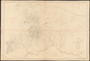
5026.
Map of Cumberland County, Pennsylvania : from actual surveys
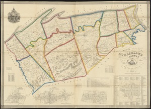
5027.
Map of Cuyahoga County, Ohio
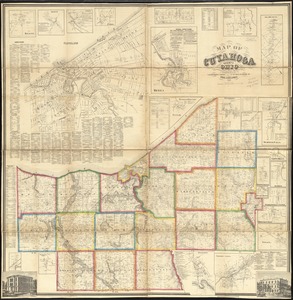
5028.
Map of De Kalb Co., Indiana
5029.
Map of De Kalb County, Illinois
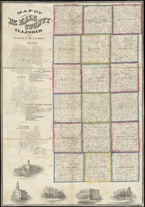
5030.
Map of defenses of New York Island from Fort Washington to Fort Independence, with redoubts, etc. planned between
5031.
Map of Delaware County, New York
5032.
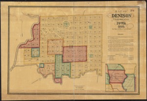
Map of Denison, Crawford County, Iowa
5033.
Map of Doobaunt and Kazan Rivers and northwest coast of Hudson Bay
5034.
Map of Dorchester
5035.
Map of Dorchester Mass
5036.
Map of Dorchester, Roxbury, and West Roxbury
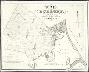
5037.
Map of Duxbury, Mass
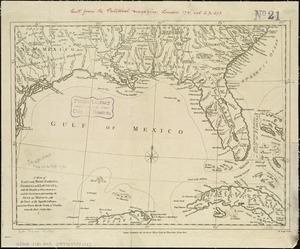
5038.
A map of East and West Florida, Georgia, and Louisiana, with the islands of Cuba, Bahama, and the countries surrounding the...
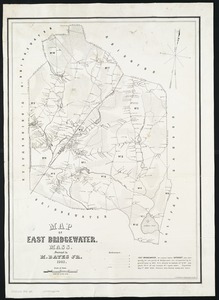
5039.
Map of East Bridgewater, Mass
5040.
Map of East Florida from St. Augustine to Tampa Bay
‹ Prev
Next ›
1
2
…
248
249
250
251
252
253
254
255
256
…
678
679