Toggle navigation
LMEC Home
Exhibitions
Georeferencing
Tools for Teachers
Collections
My Favorites
Sign Up / Log In
Search
Search the map portal
Map Collection
Map Collection
Map Sets
Search
Search
Search for
Search In
All Fields
Creator
Title
Subject
Place
Search All Digital Collections
Advanced Search
13683 Results
Filter your Search
Place
North and Central America
10,345
United States
8,476
Massachusetts
2,789
Suffolk (county)
1,677
Boston
1,633
Europe
1,417
Canada
950
New York
649
more
Place
»
Topic
Boston (Mass.)--Maps
747
City planning--Massachusetts--Boston--Maps
418
United States--History--Revolution, 1775-1783--Maps
329
United States--Maps
322
Real property--Massachusetts--Boston--Maps
254
Urban renewal--Massachusetts--Boston--Maps
254
Massachusetts--Maps
231
Insurance surveys
197
more
Topic
»
Date
Date range begin
–
Date range end
Current results range from
1482
to
2023
View distribution
Creator
United States. Hydrographic Office
597
Boston Redevelopment Authority
404
Des Barres, Joseph F. W. (Joseph Frederick Wallet), 1722-1824
247
Royal United Services Institute for Defence and Security Studies
160
Jefferys, Thomas, -1771
154
George, III, King of Great Britain, 1738-1820
152
George, IV, King of Great Britain, 1762-1830
151
O.H. Bailey & Co
148
more
Creator
»
Format
Maps/Atlases
13,502
Manuscripts
985
Prints
102
Books
49
Drawings/Illustrations
44
Photographs
15
Objects/Artifacts
13
Documents
7
more
Format
»
Georeferenced
Yes
979
No
12,704
Collection
Norman B. Leventhal Map & Education Center Collection
9,098
American Revolutionary War-Era Maps
3,305
Boston and New England Maps
2,915
Urban Maps
2,473
Maritime Charts and Atlases
1,169
William L. Clements Library Collection
910
Library of Congress Collection
618
Boston Redevelopment Authority Collection
475
more
Collection
»
Available to use
No known restrictions
10,249
Creative Commons license
1,678
Search Constraints
Sort by relevance
relevance
title
date (asc)
date (desc)
Number of results to display per page
20 per page
10
per page
20
per page
50
per page
100
per page
View results as:
grid view
map view
Search Results
12861.
Trolley wayfinder, birds eye view of trolley routes in New England
12862.
[Troops on parade, the Charles River and Castle Island]
12863.
Troy, N.Y : 1877
12864.
A true coppy from an ancient plan of E. Hutchinson's, Esqr. & from Jose. Heath in 1719 & Phins. Jones's survey in 1731 & from...
12865.
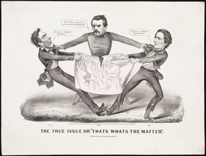
The true issue or "thats whats the matter"
12866.
A true survey of The Earl of Donagals barronie of Enish Owen containing the two adjacent harbours of Lough Foile and Lough...
12867.
Truro, Nova Scotia : 1889
12868.
Trustees of Factory Mutual Building Association of Boston, Massachusetts, Norwood, Mass. [insurance map]
12869.
Trustees' sale : beautiful building lots on Walnut St. and Walnut Avenue, in West Roxbury, containing about 3,126,519 square feet
12870.
Tsukiji hatchōbori nihonbashi minami no kuni
12871.
Ttahuantin-Suyu or the empire of the Yncas (except Quito and Chile) ... conquerers
12872.
Turcicum imperium
12873.
Turcicum imperium
12874.
Türkei und Griechenland
12875.
Turkestan and the countries between the British and the Russian dominions in Asia : mapped on the basis of the surveys made by...
12876.
Turkestan and the countries between the British and the Russian dominions in Asia : mapped on the basis of the surveys made by...
12877.
Turkey
12878.
Turkey, in Europe and Hungary : from the best authorities
12879.
Turkey in Europe, from the latest authorities
12880.
The Turkish Empire, comprising the Caucasian isthmus, with the adjoining countries, forming a complete map of the present seat...
‹ Prev
Next ›
1
2
…
640
641
642
643
644
645
646
647
648
…
684
685

![[Troops on parade, the Charles River and Castle Island]](https://bpldcassets.blob.core.windows.net/derivatives/images/commonwealth:dz010v69k/image_thumbnail_300.jpg)


![Trustees of Factory Mutual Building Association of Boston, Massachusetts, Norwood, Mass. [insurance map]](https://bpldcassets.blob.core.windows.net/derivatives/images/commonwealth:ww72c1721/image_thumbnail_300.jpg)


