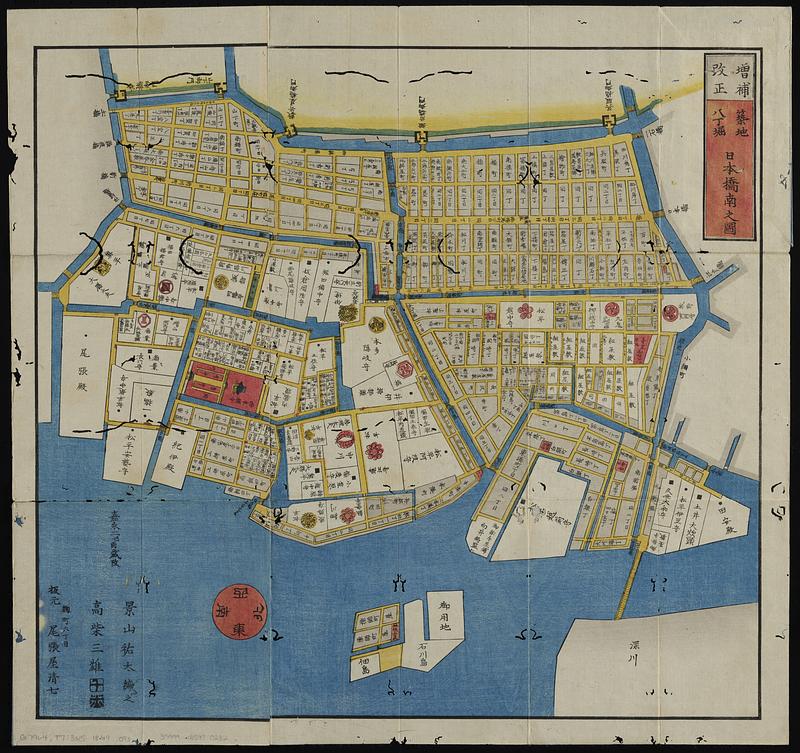
Tsukiji hatchōbori nihonbashi minami no kuni
Item Information
- Title:
- Tsukiji hatchōbori nihonbashi minami no kuni
- Title (alt.):
-
Tsukiji hatchōbori nihonbashiminami ezu
- Publisher:
- Owariya, Seishichi
- Cartographer:
- Kageyama, Muneyasu
- Cartographer:
- Takashiba, Sanʼyū, active 19th century
- Name on Item:
-
Kageyama Muneyasu hen ; Takashiba Sanyu
- Date:
-
[1859]
- Format:
-
Maps/Atlases
- Location:
-
Boston Public Library
Norman B. Leventhal Map & Education Center - Collection (local):
-
Norman B. Leventhal Map & Education Center Collection
- Subjects:
-
Nihonbashi-ku (Tokyo, Japan)--Maps
Landowners--Japan--Tokyo--Maps
Real property--Japan--Tokyo--Maps
- Places:
-
JapanNihonbashi
- Extent:
- 1 map : color ; 47 x 50 cm, folded to 17 x 10 cm
- Terms of Use:
-
No known copyright restrictions.
No known restrictions on use.
- Publisher:
-
[Edo] :
Seishichi Owariya
- Scale:
-
Scale not determined
- Language:
-
Japanese
- Notes:
-
Oriented with north to the right.
Published as part of the Edo kiriezu set of maps showing land tenure and daimyo residences; temples and shrines; roads and bridges; mountains and fields; and water features.
- Notes (date):
-
This date is inferred.
- Identifier:
-
06_01_018984
- Call #:
-
G7964 .T7:3N5 1849 .O93
- Barcode:
-
39999085970232


