Toggle navigation
LMEC Home
Exhibitions
Georeferencing
Tools for Teachers
Collections
My Favorites
Sign Up / Log In
Search
Search the map portal
Map Collection
Map Collection
Map Sets
Search
Search
Search for
Search In
All Fields
Creator
Title
Subject
Place
Search All Digital Collections
Advanced Search
2843 Results
My Search
Start Over
atlas
Remove constraint atlas
Filter your Search
Place
North and Central America
1,647
United States
987
Europe
464
Massachusetts
348
Canada
271
Asia
190
South America
189
Suffolk (county)
163
more
Place
»
Topic
Landowners--Massachusetts--Boston--Maps
115
Real property--Massachusetts--Boston--Maps
106
United States--Maps
87
Boston (Mass.)--Maps
63
United States--History--French and Indian War, 1754-1763--Maps
63
Saint Lawrence River--Maps
41
Nautical charts--Early works to 1800
39
North America--Maps--Early works to 1800
36
more
Topic
»
Date
Date range begin
–
Date range end
Current results range from
1482
to
2023
View distribution
Creator
United States. Hydrographic Office
582
Des Barres, Joseph F. W. (Joseph Frederick Wallet), 1722-1824
118
Ptolemy, 2nd cent
100
Bromley, George Washington
99
Bromley, Walter Scott
97
G.W. Bromley & Co.
75
Carey, Mathew, 1760-1839
74
Paullin, Charles Oscar, 1868 or 1869-1944
70
more
Creator
»
Format
Maps/Atlases
2,827
Manuscripts
58
Books
37
Prints
8
Documents
5
Drawings/Illustrations
1
Georeferenced
Yes
142
No
2,701
Collection
Norman B. Leventhal Map & Education Center Collection
2,386
Maritime Charts and Atlases
1,150
American Revolutionary War-Era Maps
504
Boston and New England Maps
374
Urban Maps
250
Massachusetts Real Estate Atlases
144
William L. Clements Library Collection
92
Mapping Boston Collection
61
more
Collection
»
Available to use
No known restrictions
2,292
Creative Commons license
158
Search Constraints
Sort by relevance
relevance
title
date (asc)
date (desc)
Number of results to display per page
20 per page
10
per page
20
per page
50
per page
100
per page
View results as:
grid view
map view
Search Results
1101.
A chart of the Caribe Islands
1102.
Chart of the coast of America from Cape Hateras to Cape Roman
1103.
Chart of the coast of America from Cape Hateras to Cape Roman
1104.
Chart of the coast of America from Cape Hateras to Cape Roman
1105.
Chart of the coast of America from Cape Hateras to Cape Roman
1106.
A chart of the coast of Barbaria with the western, Canaria, & Cape de Verd, isles
1107.
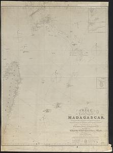
Chart of the east coast of Madagascar, including the Mauritius, Seychelle islands &c. between the latitudes of 2°30' & 26°30'...
1108.
A chart of the harbour of Halifax in Nova Scotia : with Jebucto Bay and Cape Sambro also the islands, ledges of rocks, shoals &...
1109.
A chart of the iland of Hispaniola : with the Windward passage from Iamaica betwene ye east end of Cuba & the west end of...
1110.
Chart of the north east coast of New Caledonia and part of the New Hebrides
1111.
Chart of the Philippine Islands, from the Spanish chart 1808 : the adjacent islands are added from the latest surveys
1112.
A chart of the sea coast of New Found Land, New Scotland, New England, New York, New Jersey, with Virginia and Maryland
1113.
Chart of the South Pacific Ocean, from the American Expg. Expedition, Admiralty and Depot de la Marine
1114.
A chart of the Streights of Bell Isle
1115.
Chart of the Streights of Belle Isle
1116.
Chart of the streights of Belle Isle
1117.
Chart of the streights of Belle Isle
1118.
Chart of the Viti Group or Feejee Islands
1119.
Chart of the west coast of Sumatra between Rigas and Diah from actual survey
1120.
A chart shewing part of the sea coast of Newfoundland from ye Bay of Bulls to little Plecentia
‹ Prev
Next ›
1
2
…
52
53
54
55
56
57
58
59
60
…
142
143