Toggle navigation
LMEC Home
Exhibitions
Georeferencing
Tools for Teachers
Collections
My Favorites
Sign Up / Log In
Search
Search the map portal
Map Collection
Map Collection
Map Sets
Search
Search
Search for
Search In
All Fields
Creator
Title
Subject
Place
Search All Digital Collections
Advanced Search
2487 Results
My Search
Start Over
boston atlas
Remove constraint boston atlas
Filter your Search
Place
North and Central America
1,357
United States
820
Europe
458
Massachusetts
344
Asia
188
Canada
187
South America
187
Suffolk (county)
160
more
Place
»
Topic
Landowners--Massachusetts--Boston--Maps
115
Real property--Massachusetts--Boston--Maps
106
United States--Maps
85
Boston (Mass.)--Maps
63
Nautical charts--Early works to 1800
39
Buildings--Massachusetts--Boston--Maps
34
Elections--United States--Maps
34
Nova Scotia--Maps--Early works to 1800
33
more
Topic
»
Date
Date range begin
–
Date range end
Current results range from
1482
to
2023
View distribution
Creator
United States. Hydrographic Office
582
Des Barres, Joseph F. W. (Joseph Frederick Wallet), 1722-1824
116
Ptolemy, 2nd cent
100
Bromley, George Washington
86
Bromley, Walter Scott
84
Carey, Mathew, 1760-1839
72
Paullin, Charles Oscar, 1868 or 1869-1944
70
United States Exploring Expedition (1838-1842)
70
more
Creator
»
Format
Maps/Atlases
2,478
Books
34
Manuscripts
13
Prints
8
Drawings/Illustrations
1
Georeferenced
Yes
133
No
2,354
Collection
Norman B. Leventhal Map & Education Center Collection
2,386
Maritime Charts and Atlases
1,112
Boston and New England Maps
374
American Revolutionary War-Era Maps
285
Urban Maps
250
Massachusetts Real Estate Atlases
72
Mapping Boston Collection
61
Lucius Beebe Memorial Library Historic Maps
11
more
Collection
»
Available to use
No known restrictions
2,253
Creative Commons license
73
Search Constraints
Sort by relevance
relevance
title
date (asc)
date (desc)
Number of results to display per page
20 per page
10
per page
20
per page
50
per page
100
per page
View results as:
grid view
map view
Search Results
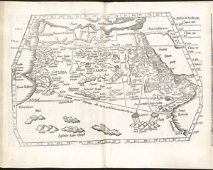
2441.
Tabula IIII Aphricae
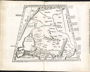
2442.
Tabula IX Asiae
2443.
Tabula IX Europae
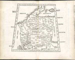
2444.
Tabula V Europae
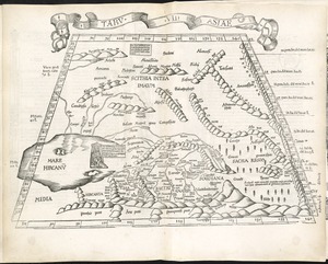
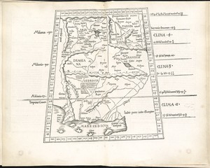
2445.
Tabula VII Asiae
2446.
Tabula VII Europae
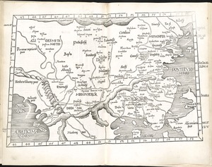
2447.
Tabula VIII Asiae
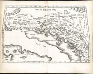
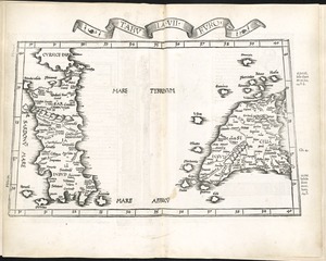
2448.
Tabula VIII Europae
2449.
Undecima Asiae tabula
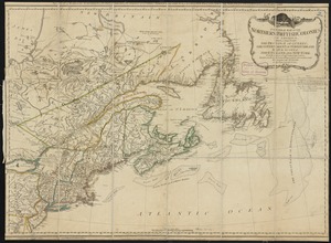
2450.
Reading Village, east side [Massachusetts] : showing streets, buildings, property boundaries and owners, railroad lines, and...
2451.
The world
2452.
A general map of the northern British Colonies in America : which comprehends the province of Quebec, the government of...
2453.
[The World]
2454.
Tabula II Asiae
2455.
Tabula IIII Europae
2456.
Greenwood, Town of Wakefield [Massachusetts]
2457.
Oceani occidetalis seu terre nove tabula
2458.
Undecima Asie tabula continet India ext. Gange & Sinas
2459.
A map of the British and French dominions in North America : with the roads, distances, limits, and extent of the settlements
2460.
Tabula XI Asiae
‹ Prev
Next ›
1
2
…
119
120
121
122
123
124
125