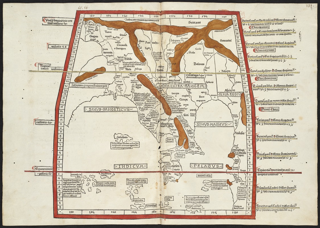
Undecima Asie tabula continet India ext. Gange & Sinas
Item Information
- Title:
- Undecima Asie tabula continet India ext. Gange & Sinas
- Creator:
- Ptolemy, 2nd cent
- Printer:
- Hol, Lienhart
- Date:
-
[1482]
- Format:
-
Maps/Atlases
- Location:
-
Boston Public Library
Norman B. Leventhal Map & Education Center - Collection (local):
-
Norman B. Leventhal Map & Education Center Collection
- Subjects:
-
India--Maps--Early works to 1800
Bangladesh--Maps--Early works to 1800
Thailand--Maps--Early works to 1800
Burma--Maps--Early works to 1800
- Places:
-
India
Bangladesh
Thailand
Myanmar
- Extent:
- 1 map : hand col ; 36 x 32 cm.
- Terms of Use:
-
No known copyright restrictions.
No known restrictions on use.
- Publisher:
-
Ulm :
Lienhart Hol
- Scale:
-
Scale [ca. 1:12,500,000]
- Language:
-
Latin
- Notes:
-
Title from verso.
Map of land east of the Ganges. The map shows the region of southeast Asia with the Ganges River in the west, the "Sinae" (China) in the east, and southeast Asia, the Indian Ocean, and China Sea.
Relief shown by brown coloring.
Engraved on wood with place names in moveable type.
Includes names of places and natural features.
In margin: notes on latitude.
Descriptive text within ornamental borders on verso.
Appears in the author's Geographia. Ulm : Lienhart Hol, 16 July 1482.
Text in Latin.
Cataloging, conservation, and digitization made possible in part by The National Endowment for the Humanities: Exploring the human endeavor.
Atlas scanned by Internet Archive http://www.archive.org/details/cosmographia00ptol
- Notes (date):
-
This date is inferred.
- Identifier:
-
06_01_000864
- Call #:
-
G1005 .P7 1482
- Barcode:
-
30000003825272


