Toggle navigation
LMEC Home
Exhibitions
Georeferencing
Tools for Teachers
Collections
My Favorites
Sign Up / Log In
Search
Search the map portal
Map Collection
Map Collection
Map Sets
Search
Search
Search for
Search In
All Fields
Creator
Title
Subject
Place
Search All Digital Collections
Advanced Search
2487 Results
My Search
Start Over
boston atlas
Remove constraint boston atlas
Filter your Search
Place
North and Central America
1,357
United States
820
Europe
458
Massachusetts
344
Asia
188
Canada
187
South America
187
Suffolk (county)
160
more
Place
»
Topic
Landowners--Massachusetts--Boston--Maps
115
Real property--Massachusetts--Boston--Maps
106
United States--Maps
85
Boston (Mass.)--Maps
63
Nautical charts--Early works to 1800
39
Buildings--Massachusetts--Boston--Maps
34
Elections--United States--Maps
34
Nova Scotia--Maps--Early works to 1800
33
more
Topic
»
Date
Date range begin
–
Date range end
Current results range from
1482
to
2023
View distribution
Creator
United States. Hydrographic Office
582
Des Barres, Joseph F. W. (Joseph Frederick Wallet), 1722-1824
116
Ptolemy, 2nd cent
100
Bromley, George Washington
86
Bromley, Walter Scott
84
Carey, Mathew, 1760-1839
72
Paullin, Charles Oscar, 1868 or 1869-1944
70
United States Exploring Expedition (1838-1842)
70
more
Creator
»
Format
Maps/Atlases
2,478
Books
34
Manuscripts
13
Prints
8
Drawings/Illustrations
1
Georeferenced
Yes
133
No
2,354
Collection
Norman B. Leventhal Map & Education Center Collection
2,386
Maritime Charts and Atlases
1,112
Boston and New England Maps
374
American Revolutionary War-Era Maps
285
Urban Maps
250
Massachusetts Real Estate Atlases
72
Mapping Boston Collection
61
Lucius Beebe Memorial Library Historic Maps
11
more
Collection
»
Available to use
No known restrictions
2,253
Creative Commons license
73
Search Constraints
Sort by relevance
relevance
title
date (asc)
date (desc)
Number of results to display per page
20 per page
10
per page
20
per page
50
per page
100
per page
View results as:
grid view
map view
Search Results
2401.
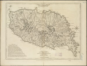
Carte de l'Isle de la Grenade cédée a la Grand Bretagne par le dernier traité de paix = Grenada divided into its parishes :...
2402.
Cuba Insula ; Hispaniola Insula
2403.
Curaçao
2404.
An exact chart of the river St. Laurence, from Fort Frontenac to the island of Anticosti shewing the soundings, rocks, shoals...
2405.
Guadaloupe, done from actual surveys and observations of the English : whilst the island was in their possession
2406.
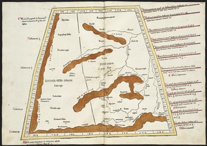
II Tabula moderna Aphrice
2407.
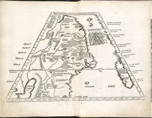
Libyae interioris pars
2408.
New Found Land, St. Laurence Bay, the fishing banks, Acadia, and part of New Scotland
2409.
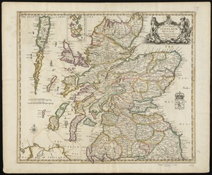
A new map of Scotland with the roads
2410.
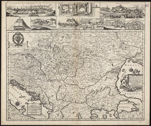
A new mapp of the Kingdom of Hungary and the states that have been subject to it, which are at present the northern parts of...
2411.
Octava Asie tabula continet Scythiam que citra Imaū est & seras
2412.
Quarta Europe tabula continet Germaniam
2413.
Secunda Asie tabula continet Sarmatia ipsius
2414.
Septima Asia tabula continet Margianam, Bactrianam, Sogdianos, Sacas & Scythiam intra Imaū mōtē
2415.
Septima Europae tabula
2416.
Ta. here. Helve
2417.
Ta. superioris Indiae et Tartariae maioris
2418.
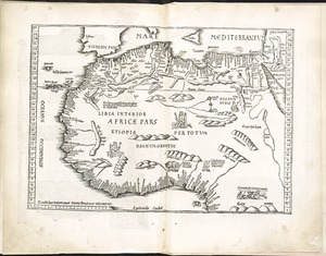
Tab. mo. primae partis Aphricae, et tabula secunde partis Aphricae
2419.
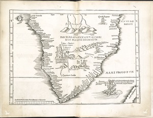
Tab. mo. secundae partis Aphricae
2420.
Tab. nova Norbegiae et Gottiae
‹ Prev
Next ›
1
2
…
117
118
119
120
121
122
123
124
125