Toggle navigation
LMEC Home
Exhibitions
Georeferencing
Tools for Teachers
Collections
My Favorites
Sign Up / Log In
Search
Search the map portal
Map Collection
Map Collection
Map Sets
Search
Search
Search for
Search In
All Fields
Creator
Title
Subject
Place
Search All Digital Collections
Advanced Search
13518 Results
Filter your Search
Place
North and Central America
10,232
United States
8,367
Massachusetts
2,778
Suffolk (county)
1,675
Boston
1,631
Europe
1,386
Canada
949
New York
640
more
Place
»
Topic
Boston (Mass.)--Maps
746
City planning--Massachusetts--Boston--Maps
418
United States--History--Revolution, 1775-1783--Maps
329
United States--Maps
321
Real property--Massachusetts--Boston--Maps
254
Urban renewal--Massachusetts--Boston--Maps
254
Massachusetts--Maps
230
Insurance surveys
197
more
Topic
»
Date
Date range begin
–
Date range end
Current results range from
1482
to
2023
View distribution
Creator
United States. Hydrographic Office
596
Boston Redevelopment Authority
404
Des Barres, Joseph F. W. (Joseph Frederick Wallet), 1722-1824
247
Royal United Services Institute for Defence and Security Studies
160
Jefferys, Thomas, -1771
154
George, III, King of Great Britain, 1738-1820
152
George, IV, King of Great Britain, 1762-1830
151
O.H. Bailey & Co
148
more
Creator
»
Format
Maps/Atlases
13,337
Manuscripts
985
Prints
102
Books
49
Drawings/Illustrations
44
Photographs
15
Objects/Artifacts
13
Documents
7
more
Format
»
Georeferenced
Yes
979
No
12,539
Collection
Norman B. Leventhal Map & Education Center Collection
9,022
American Revolutionary War-Era Maps
3,305
Boston and New England Maps
2,900
Urban Maps
2,425
Maritime Charts and Atlases
1,167
William L. Clements Library Collection
910
Library of Congress Collection
618
Boston Redevelopment Authority Collection
475
more
Collection
»
Available to use
No known restrictions
10,085
Creative Commons license
1,677
Search Constraints
Sort by relevance
relevance
title
date (asc)
date (desc)
Number of results to display per page
20 per page
10
per page
20
per page
50
per page
100
per page
View results as:
grid view
map view
Search Results
2221.
A chart of the West Indies from Cape Cod to the River Oronoque
2222.
A chart of the West Indies, from the latest marine journals and surveys
2223.
A chart of the western coast of Africa, from the Straits of Gibraltar to eleven degrees of north latitude : including the...
2224.
A chart of the world, according to Mercators projection, shewing the latest discoveries of Capt. Cook
2225.
Chart of the world according to Mercators projection, shewing the tracks & discoveries of Captn. Cook
2226.
Chart of the world, on Mercator's projection : illustrative of the impolicy of slavery
2227.
Chart of the world showing area in the Pacific Ocean having Hawaii as the only base of supplies in transpacific voyages and...
2228.
A chart of the world upon Mercator's projection : describing the tracks of Capt. Cook in the year 1768, 69, 70, 71, and in...
2229.
A chart of Tibee Inlet in Georgia
2230.
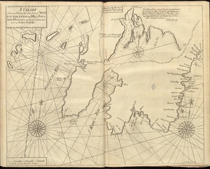
[Chart of Tierra del Fuego and the Strait of Magellan]
2231.
A chart shewing part of the sea coast of Newfoundland from ye Bay of Bulls to little Plecentia
2232.
Chart shewing the tracks across the North Atlantic Ocean of Don Christopher Columbus
2233.
A chart shewing the tract of Capt. Cook's last voyage, 1799
2234.
Chart showing the depth of the James and York rivers as they enter Chesapeake Bay, with towns adjacent
2235.
Charte der vereinigten Königreiche Grosbritanien und Ireland : nach den neuesten Berichtigungen und Astronomischen...
2236.
Charte des Königreichs Daenemark : nach Murdochischer Projection und nach den trigonometrischen Charten der König
2237.
Charte über die XIII Vereinigte Staaten von Nord-America
2238.
Charte von den Königreichen Preussen und Polen dem Grosherzogthum Posen nebst dem Gebiete der freien Stadt Krakau : nach dem...
2239.
Charte von Italien : Nach seiner neuesten Eintheilung und den vorzüglichsten Hülfsmitteln
2240.
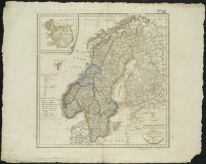
Charte von Schweden und Norwegen
‹ Prev
Next ›
1
2
…
108
109
110
111
112
113
114
115
116
…
675
676


![[Chart of Tierra del Fuego and the Strait of Magellan]](https://bpldcassets.blob.core.windows.net/derivatives/images/commonwealth:w9505s59b/image_thumbnail_300.jpg)