Toggle navigation
LMEC Home
Exhibitions
Georeferencing
Tools for Teachers
Collections
My Favorites
Sign Up / Log In
Search
Search the map portal
Map Collection
Map Collection
Map Sets
Search
Search
Search for
Search In
All Fields
Creator
Title
Subject
Place
Search All Digital Collections
Advanced Search
2843 Results
My Search
Start Over
atlas
Remove constraint atlas
Filter your Search
Place
North and Central America
1,647
United States
987
Europe
464
Massachusetts
348
Canada
271
Asia
190
South America
189
Suffolk (county)
163
more
Place
»
Topic
Landowners--Massachusetts--Boston--Maps
115
Real property--Massachusetts--Boston--Maps
106
United States--Maps
87
Boston (Mass.)--Maps
63
United States--History--French and Indian War, 1754-1763--Maps
63
Saint Lawrence River--Maps
41
Nautical charts--Early works to 1800
39
North America--Maps--Early works to 1800
36
more
Topic
»
Date
Date range begin
–
Date range end
Current results range from
1482
to
2023
View distribution
Creator
United States. Hydrographic Office
582
Des Barres, Joseph F. W. (Joseph Frederick Wallet), 1722-1824
118
Ptolemy, 2nd cent
100
Bromley, George Washington
99
Bromley, Walter Scott
97
G.W. Bromley & Co.
75
Carey, Mathew, 1760-1839
74
Paullin, Charles Oscar, 1868 or 1869-1944
70
more
Creator
»
Format
Maps/Atlases
2,827
Manuscripts
58
Books
37
Prints
8
Documents
5
Drawings/Illustrations
1
Georeferenced
Yes
142
No
2,701
Collection
Norman B. Leventhal Map & Education Center Collection
2,386
Maritime Charts and Atlases
1,150
American Revolutionary War-Era Maps
504
Boston and New England Maps
374
Urban Maps
250
Massachusetts Real Estate Atlases
144
William L. Clements Library Collection
92
Mapping Boston Collection
61
more
Collection
»
Available to use
No known restrictions
2,292
Creative Commons license
158
Search Constraints
Sort by relevance
relevance
title
date (asc)
date (desc)
Number of results to display per page
20 per page
10
per page
20
per page
50
per page
100
per page
View results as:
grid view
map view
Search Results
2761.
Tabula IX Europae
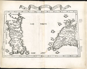
2762.
Tabula V Europae
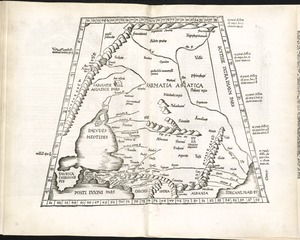
2763.
Tabula VII Asiae
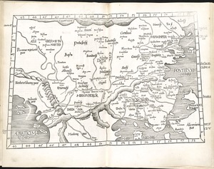
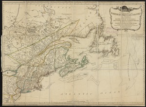
2764.
Tabula VII Europae
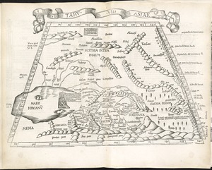
2765.
Tabula VIII Asiae
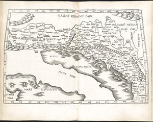
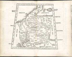
2766.
Tabula VIII Europae
2767.
Undecima Asiae tabula
2768.
Wakefield [Massachusetts] ; Greenwood ; Melrose
2769.
A general map of the northern British Colonies in America : which comprehends the province of Quebec, the government of...
2770.
Lake Champlain and Lake George, and the country between the Hudson and the lakes on the west, and Connecticut River on the east
2771.
Tabula II Asiae
2772.
Tabula IIII Europae
2773.
[The World]
2774.
The world
2775.
Oceani occidetalis seu terre nove tabula
2776.
Undecima Asie tabula continet India ext. Gange & Sinas
2777.
L'Atlas de mer ou monde aquatique, remontrant toutes les côtes de la mer, a scavoir de la partie connuë de I'Univers, avec une...
2778.
The English pilot. The fourth book. Describing the West-India navigation, from Hudson's-Bay to the River Amazones. Particulary...
2779.
New Englands prospect : A true, lively, and experimentall description of that part of America, commonly called New England:...
2780.
Theatro del mondo di Abrahamo Ortelio : da lui poco inanzi la sua morte riueduto, & di tauole nuoue, et commenti adorno, &...
‹ Prev
Next ›
1
2
…
135
136
137
138
139
140
141
142
143