Toggle navigation
LMEC Home
Exhibitions
Georeferencing
Tools for Teachers
Collections
My Favorites
Sign Up / Log In
Search
Search the map portal
Map Collection
Map Collection
Map Sets
Search
Search
Search for
Search In
All Fields
Creator
Title
Subject
Place
Search All Digital Collections
Advanced Search
13529 Results
Filter your Search
Place
North and Central America
10,241
United States
8,375
Massachusetts
2,782
Suffolk (county)
1,677
Boston
1,633
Europe
1,387
Canada
950
New York
641
more
Place
»
Topic
Boston (Mass.)--Maps
747
City planning--Massachusetts--Boston--Maps
418
United States--History--Revolution, 1775-1783--Maps
329
United States--Maps
321
Real property--Massachusetts--Boston--Maps
254
Urban renewal--Massachusetts--Boston--Maps
254
Massachusetts--Maps
230
Insurance surveys
197
more
Topic
»
Date
Date range begin
–
Date range end
Current results range from
1482
to
2023
View distribution
Creator
United States. Hydrographic Office
596
Boston Redevelopment Authority
404
Des Barres, Joseph F. W. (Joseph Frederick Wallet), 1722-1824
247
Royal United Services Institute for Defence and Security Studies
160
Jefferys, Thomas, -1771
154
George, III, King of Great Britain, 1738-1820
152
George, IV, King of Great Britain, 1762-1830
151
O.H. Bailey & Co
148
more
Creator
»
Format
Maps/Atlases
13,348
Manuscripts
985
Prints
102
Books
49
Drawings/Illustrations
44
Photographs
15
Objects/Artifacts
13
Documents
7
more
Format
»
Georeferenced
Yes
979
No
12,550
Collection
Norman B. Leventhal Map & Education Center Collection
9,033
American Revolutionary War-Era Maps
3,305
Boston and New England Maps
2,906
Urban Maps
2,426
Maritime Charts and Atlases
1,167
William L. Clements Library Collection
910
Library of Congress Collection
618
Boston Redevelopment Authority Collection
475
more
Collection
»
Available to use
No known restrictions
10,096
Creative Commons license
1,677
Search Constraints
Sort by relevance
relevance
title
date (asc)
date (desc)
Number of results to display per page
20 per page
10
per page
20
per page
50
per page
100
per page
View results as:
grid view
map view
Search Results
13101.
Virginiae partis australis, et Floridae partis orientalis, interjacentiumq[ue] regionum nova descriptio
13102.
Virginiae partis australis et Floridae partis orientalis, interjacentium[que] regionum nova descriptio
13103.
A vision of Private Kutschkes of the German National Guard = Traumgebild des deutschen Landwehrmanns Kutschke!
13104.
Vltoniae orientalis : pars
13105.
Vmbria overo ducato di Spoleto
13106.
VOC contamination and public water supplies in the commonwealth of Massachusetts
13107.
Völker und sprachen-karte von Deutschland und den nachbarländern im j. 1867
13108.
Volunteer militia and eastern army guide : One hundred and fifty miles around Richmond
13109.
Vom Rhein bis Paris
13110.
Vorstellung der diversio welche der Enll. Generel Lieutenant Clinton samt dene Generals Vaughan u. Tryon in de Ierseys im Sept....
13111.
Vorstellung einiger Gegenden und Plaetze in Nord-America unter Franzoesisch und Englische Jurisdiction gehoerig
13112.
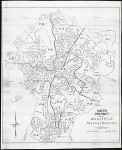
Voter precinct map of Wakefield, Massachusetts
13113.
Vtriusque Castellae nova descriptio
13114.
La vue a vol d'oiseau de l'Abbaye de Saint-Martin de Laon (de l'Ordre de Prémontré)
13115.
Vue de Quebec, capitale du Canada
13116.
Vue du Port-au-Prince et ses environs
13117.
W. & A.K. Johnston's map to illustrate the Chinese question
13118.
W. & A.K. Johnston's maps to illustrate the Niger and Upper Nile questions
13119.
W. Br. Pine Cr
13120.
W. Su[q.?] Cr., Bradford Co
‹ Prev
Next ›
1
2
…
652
653
654
655
656
657
658
659
660
…
676
677
![Virginiae partis australis, et Floridae partis orientalis, interjacentiumq[ue] regionum nova descriptio](https://bpldcassets.blob.core.windows.net/derivatives/images/commonwealth:st74cw930/image_thumbnail_300.jpg)
![Virginiae partis australis et Floridae partis orientalis, interjacentium[que] regionum nova descriptio](https://bpldcassets.blob.core.windows.net/derivatives/images/commonwealth:6t053p120/image_thumbnail_300.jpg)


![W. Su[q.?] Cr., Bradford Co](https://bpldcassets.blob.core.windows.net/derivatives/images/commonwealth:q524ng417/image_thumbnail_300.jpg)