Toggle navigation
LMEC Home
Exhibitions
Georeferencing
Tools for Teachers
Collections
My Favorites
Sign Up / Log In
Search
Search the map portal
Map Collection
Map Collection
Map Sets
Search
Search
Search for
Search In
All Fields
Creator
Title
Subject
Place
Search All Digital Collections
Advanced Search
13680 Results
Filter your Search
Place
North and Central America
10,344
United States
8,475
Massachusetts
2,789
Suffolk (county)
1,677
Boston
1,633
Europe
1,415
Canada
950
New York
649
more
Place
»
Topic
Boston (Mass.)--Maps
747
City planning--Massachusetts--Boston--Maps
418
United States--History--Revolution, 1775-1783--Maps
329
United States--Maps
322
Real property--Massachusetts--Boston--Maps
254
Urban renewal--Massachusetts--Boston--Maps
254
Massachusetts--Maps
231
Insurance surveys
197
more
Topic
»
Date
Date range begin
–
Date range end
Current results range from
1482
to
2023
View distribution
Creator
United States. Hydrographic Office
597
Boston Redevelopment Authority
404
Des Barres, Joseph F. W. (Joseph Frederick Wallet), 1722-1824
247
Royal United Services Institute for Defence and Security Studies
160
Jefferys, Thomas, -1771
154
George, III, King of Great Britain, 1738-1820
152
George, IV, King of Great Britain, 1762-1830
151
O.H. Bailey & Co
148
more
Creator
»
Format
Maps/Atlases
13,499
Manuscripts
985
Prints
102
Books
49
Drawings/Illustrations
44
Photographs
15
Objects/Artifacts
13
Documents
7
more
Format
»
Georeferenced
Yes
979
No
12,701
Collection
Norman B. Leventhal Map & Education Center Collection
9,096
American Revolutionary War-Era Maps
3,305
Boston and New England Maps
2,915
Urban Maps
2,471
Maritime Charts and Atlases
1,169
William L. Clements Library Collection
910
Library of Congress Collection
618
Boston Redevelopment Authority Collection
475
more
Collection
»
Available to use
No known restrictions
10,246
Creative Commons license
1,678
Search Constraints
Sort by relevance
relevance
title
date (asc)
date (desc)
Number of results to display per page
20 per page
10
per page
20
per page
50
per page
100
per page
View results as:
grid view
map view
Search Results
2701.
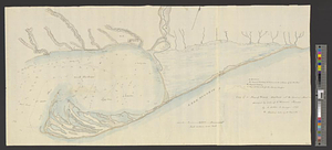
Copy of a map presented to the Congres [sic]
2702.
Copy of a plan of South Bay
2703.
Copy of a plan of the river Iberville from Lake Maurepas to the forks, with part of the Comit and Amit : taken from engineer...
2704.
Copy of a plan of York harbour with the soundings, shoals &c. surveyed by order of Lt Governor Simcoe
2705.
Copy of a sketch of the Monongahela, with the field of battle
2706.
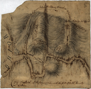
Copy of a survey return'd by Mr. Sam Lewis, surveyor of Botetourt Coun[t]y : Surveyed for George Washington 2950 acres of land...
2707.
Copy of an ancient plan belonging to the City (not dated probably about 1738)
2708.
Copy of an old plan belonging to the city
2709.
Copy of part of plan of inner harbor of Boston, showing commissioners' lines
2710.
A Copy of the Plan returned by his Maj:tys Com:rs for setling the Boundarys between the Provinces of New Hampshire and the...
2711.
Corey Hill Terraces, Brookline
2712.
Cornell University campus
2713.
Cornubia, Davonia, Somersetus, Dorcestria, Wiltonia, Glocestria, Monumetha, Glamorgan, Caermarden, Pembroke, Cardigan, Radnor,...
2714.
A correct chart of the North Sea, with the adjacent coasts of Britain, Holland, Germany, Denmark, Norway, the islands of Orkney...
2715.
A Correct chart of the West India islands : engraved for Malham's naval gazetteer
2716.
A correct map of Connecticut from actual survey
2717.
A correct map of Europe divided into its empire, kingdoms &c.
2718.
A correct map of Pensacola Bay showing topography of the coast, Fort Pickens, U.S. Navy Yard, and all other fortifications from...
2719.
A correct map of the African islands of Bourbon, and Mauritius or the Isle of France
2720.
A correct map of the coast of New England
‹ Prev
Next ›
1
2
…
132
133
134
135
136
137
138
139
140
…
683
684
![Copy of a map presented to the Congres [sic]](https://bpldcassets.blob.core.windows.net/derivatives/images/commonwealth:z603vn16x/image_thumbnail_300.jpg)


![Copy of a survey return'd by Mr. Sam Lewis, surveyor of Botetourt Coun[t]y](https://bpldcassets.blob.core.windows.net/derivatives/images/commonwealth:q524nf40r/image_thumbnail_300.jpg)