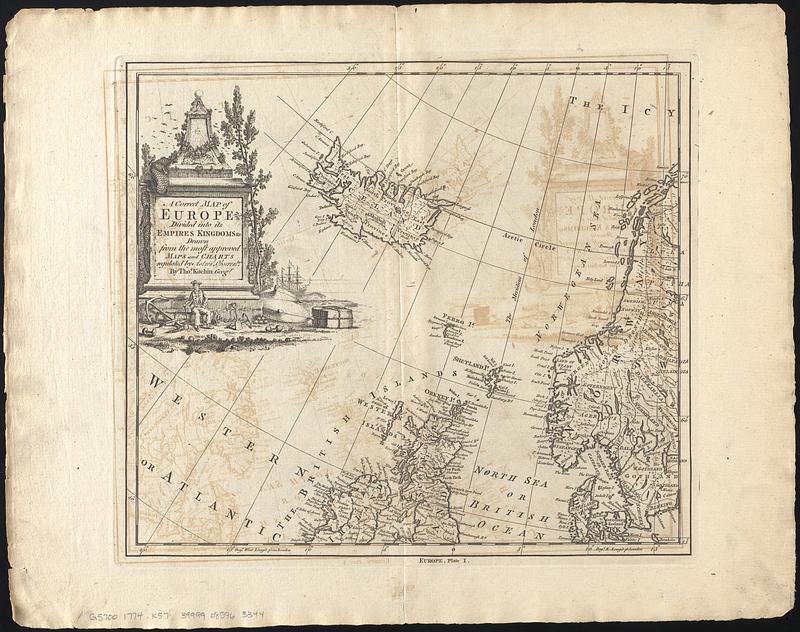
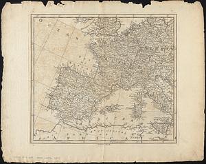
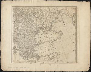
A correct map of Europe divided into its empire, kingdoms &c.

Item Information
- Title:
- A correct map of Europe divided into its empire, kingdoms &c.
- Cartographer:
- Kitchin, Thomas, 1719-1784
- Name on Item:
-
drawn from the most approved maps and charts regulated by astronl. observatns. by Thos. Kitchin, geogr.
- Date:
-
[1774]
- Format:
-
Maps/Atlases
- Location:
-
Boston Public Library
Norman B. Leventhal Map & Education Center - Collection (local):
-
Norman B. Leventhal Map & Education Center Collection
- Subjects:
-
Europe--Maps--Early works to 1800
- Places:
-
Europe
Europe
- Extent:
- 1 map on 4 sheets ; 67 x 76 cm, on sheets 44 x 56 cm
- Terms of Use:
-
No known copyright restrictions.
No known restrictions on use.
- Publisher:
-
[London] :
[Printed for W. Strahan, J. and F. Rivington, J. Hinton [and others]]
- Scale:
-
Scale approximately 1:6,400,000
- Language:
-
English
- Notes:
-
Relief shown pictorially.
Inset: [Icy Sea and northern Scandinavia].
From The universal dictionary of trade and commerce volume I / by Malachy Postlethwayt. 4th edition. London : Printed for W. Strahan, J. and F. Rivington, J. Hinton [and others], 1774.
Decorative title cartouche.
Boston Public Library lacking plate II.
- Notes (date):
-
This date is inferred.
- Identifier:
-
06_01_017826C
06_01_017826B
06_01_017826A
- Call #:
-
G5700 1774 .K57
- Barcode:
-
39999085963344