Toggle navigation
LMEC Home
Exhibitions
Georeferencing
Tools for Teachers
Collections
My Favorites
Sign Up / Log In
Search
Search the map portal
Map Collection
Map Collection
Map Sets
Search
Search
Search for
Search In
All Fields
Creator
Title
Subject
Place
Search All Digital Collections
Advanced Search
13385 Results
Filter your Search
Place
North and Central America
9,353
United States
7,286
Suffolk (county)
1,664
Boston
1,621
Europe
1,035
Canada
949
Massachusetts
875
New York
534
more
Place
»
Topic
Boston (Mass.)--Maps
741
City planning--Massachusetts--Boston--Maps
418
United States--History--Revolution, 1775-1783--Maps
329
United States--Maps
315
Urban renewal--Massachusetts--Boston--Maps
254
Real property--Massachusetts--Boston--Maps
252
Massachusetts--Maps
219
Insurance surveys
197
more
Topic
»
Date
Date range begin
–
Date range end
Current results range from
1482
to
2023
View distribution
Creator
United States. Hydrographic Office
595
Boston Redevelopment Authority
403
Des Barres, Joseph F. W. (Joseph Frederick Wallet), 1722-1824
247
Royal United Services Institute for Defence and Security Studies
160
Jefferys, Thomas, -1771
154
George, III, King of Great Britain, 1738-1820
152
George, IV, King of Great Britain, 1762-1830
151
O.H. Bailey & Co
148
more
Creator
»
Format
Maps/Atlases
13,205
Manuscripts
985
Prints
102
Books
49
Drawings/Illustrations
44
Photographs
15
Objects/Artifacts
13
Documents
7
more
Format
»
Georeferenced
Yes
979
No
12,406
Collection
Norman B. Leventhal Map Center Collection
8,891
American Revolutionary War-Era Maps
3,305
Boston and New England Maps
2,804
Urban Maps
2,397
Maritime Charts and Atlases
1,150
William L. Clements Library Collection
910
Library of Congress Collection
618
Boston Redevelopment Authority Collection
475
more
Collection
»
Available to use
No known restrictions
9,952
Creative Commons license
1,677
Search Constraints
Sort by relevance
relevance
title
date (asc)
date (desc)
Number of results to display per page
100 per page
10
per page
20
per page
50
per page
100
per page
View results as:
grid view
map view
Search Results
2301.
Circulus Franconius, in quo sunt episcopatus Wurtzburg, Bamberg et Aichstet : Status equitum Teutonicor ducatus Coburgensis :...
2302.
Circulus Saxoniae inferioris in quo sunt ducatus Holsatiae, Mecklenburgi, Lauwenburgi, Luneburgi, Brunsuigi, Bremae et Ferdae,...
2303.
Circulus Suevicus in quo sunt Ducatus Wirtenbergensis, Marchionatus Badensis & Burgoviensis, Comitatus Otting, Rechberg,...
2304.
Circulus Westphalicus, sive Germaniae inferioris
2305.
Cities of East Saginaw and Saginaw, Michigan, 1885
2306.
Citizens & travelers guide map in, to and from the city of New York and adjacent places
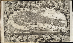
2307.
Citta di Venezia
2308.
City atlas of Boston, Massachusetts : complete in one volume : from official records, private plans and actual surveys
2309.
City atlas of Haverhill, Massachusetts
2310.
City atlas of Lawrence, Massachusetts : from official records, private plans and actual surveys, based upon plans deposited in...
2311.
City atlas of Lawrence, Massachusetts
2312.
City atlas of Lowell, Massachusetts
2313.
City atlas of Lynn, Massachusetts : from official records, private plans and actual surveys
2314.
The city of Binghamton, Broome Co., N.Y : as extended May 19th, 1908
2315.
The City of Boston : 1879
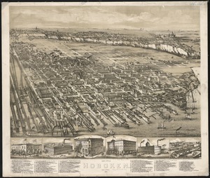
2316.
The city of Boston
2317.
The City of Boston : 1879
2318.
The city of Boston : 1879
2319.
City of Boston
2320.
City of Boston : topographic and planimetric survey
2321.
City of Boston Granary Burying Ground : Boston proper
2322.
City of Boston improved sewerage : plan showing location of main and secondary intercepting sewers
2323.
City of Boston improved sewerage : plan showing region drained by, and lines of proposed intercepting sewer, also course of...
2324.
City of Boston plan of Columbia Road, showing connection with Franklin Park and Marine Park : under chapter 394 acts of 1897
2325.
City of Boston topographic and planimetric survey : [Downtown and North End]
2326.
City of Boston topographic and planimetric survey
2327.
City of Boston zoning map
2328.
City of Boston zoning map
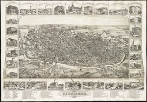
2329.
City of Brockton
2330.
City of Butte : indexed map showing Butte and vicinity with location of mines, schools, public buildings, streets, etc
2331.
City of Cambridge, Mass : 1877
2332.
City of Chelsea with the location of its churches, schools and principal industries
2333.
City of Chicopee
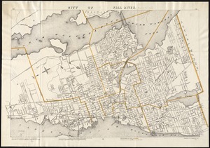
2334.
City of Fall River
2335.
City of Fall River, Mass : 1877
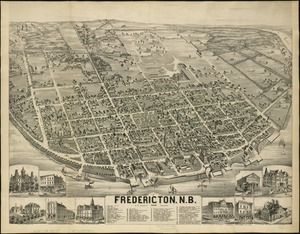
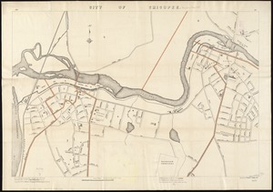
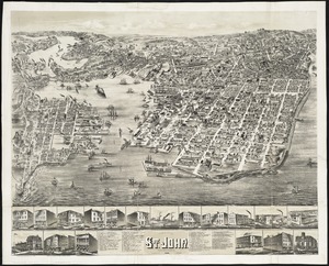
2336.
City of Fredericton, N.B
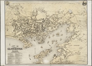
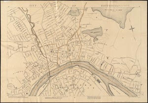
2337.
City of Gloucester, Mass
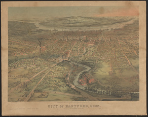
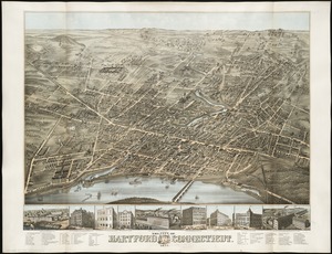
2338.
City of Hartford, Conn.
2339.
The city of Hartford Connecticut : 1877
2340.
City of Haverhill, Massachusetts
2341.
The city of Hoboken : New Jersey, 1881
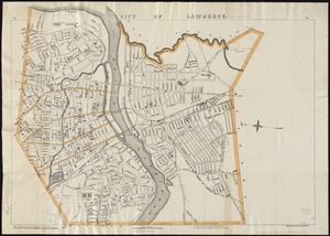
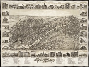
2342.
City of Lawrence
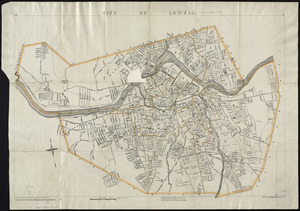
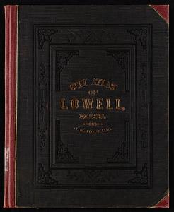
2343.
City of Lowell
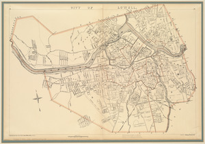
2344.
City of Lowell
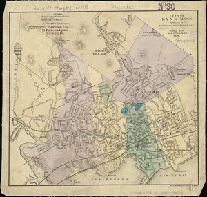
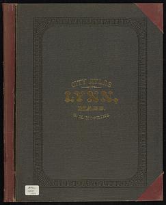
2345.
City of Lynn, Mass
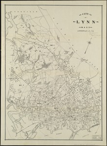
2346.
City of Lynn, Mass
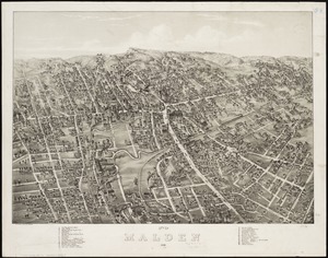
2347.
City of Malden : 1881
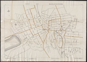
2348.
City of Marlborough
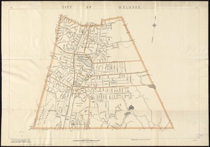
2349.
City of Melrose
2350.
City of Melrose assessors plans
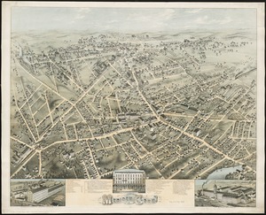
2351.
City of Meriden, Conn
2352.
The city of New Haven, Conn : 1879
2353.
The city of New York as laid out by the Commissioners with the surrounding country
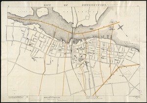
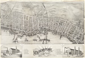
2354.
City of Newburyport
2355.
The city of Newburyport, Massachusetts
2356.
City of New-York
2357.
[City of Niagara Falls]
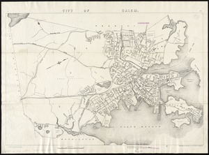
2358.
City of Norwich, Conn : 1876
2359.
The city of Richmond, Indiana : 1884
2360.
City of Salem
2361.
City of San Francisco and its vicinity, California
2362.
City of Somerville : ward 3 : voting precincts
2363.
City of Spokane, 1910, Washington : from official records
2364.
City of St. Augustine and environs
2365.
The city of St. John : New Brunswick
2366.
City of Taunton
2367.
City of Taunton, Mass : 1875
2368.
City of Toronto : compiled from surveys made to the present date
2369.
City of Toronto, reduced by permission from Wadsworth & Unwin's large map
2370.
A city of unequal risks
2371.
City of Utica
2372.
The city of Vineland, New Jersey : 1885
2373.
City of Washington
2374.
City of White Plains, Westchester County, New York
2375.
The city of Worcester, Mass : 1878
2376.
Civil airways of the United States as designated in Civil Air Regulations - chapter 60
2377.
Civil War centennial
2378.
Civitas Londinum ano. dmi. circiter MDLX
2379.
Clappville
2380.
Clare, Mich : 1884
2381.
Clark County, Wis.
2382.
Clason's map of Los Angeles
2383.
Clayton, Delaware : 1885
2384.
Clearwater Manufacturing Company (Finishing Plant), Clearwater, S.C. [insurance map]
2385.
Clemens' map of Pennsylvania
2386.
Clemens' silent teacher, dissected map of the United States and of each state in counties
2387.
The Clermont on the Hudson River, 1810
2388.
[Cliftondale, Saugus and East Saugus, Massachusetts] : 1896
2389.
Climate zones for Eastern Asia
2390.
Clothing recommendations for travel in China
2391.
Clue plan for Collins' illustrated guide to London
2392.
Clyde, River Point and Arctic, Rhode Island
2393.
Coal areas of Canada
2394.
Coal fields of Alberta and British Columbia
2395.
Coal fields of Manitoba and Saskatchewan
2396.
Coal fields of Nova Scotia and New Brunswick
2397.
Coast and islands between Queen Charlotte Sound and Burke Channel, British Columbia
2398.
Coast chart no. 186 : Choctawhatchee Inlet to Pensacola Entrance, West Florida : report of Navy Yard Site Commission, Gulf of...
2399.
The coast from St. Johns, New Brunswick, to Goldsborough Bay, Maine
2400.
The coast of a part of New England, New York, New Jersey, Pensilvania, Maryland, Virginia, and part of North Carolina &c. with...
‹ Prev
Next ›
1
2
…
20
21
22
23
24
25
26
27
28
…
133
134