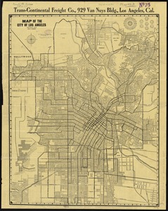
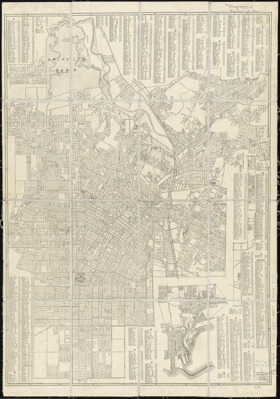
Clason's map of Los Angeles
Item Information
- Title:
- Clason's map of Los Angeles
- Panel title :
- Map of Los Angeles
- Creator:
- Clason Map Co
- Date:
-
[ca. 1920]
- Format:
-
Maps/Atlases
- Location:
-
Boston Public Library
Norman B. Leventhal Map & Education Center - Collection (local):
-
Norman B. Leventhal Map & Education Center Collection
- Subjects:
-
Los Angeles (Calif.)--Maps
- Places:
-
CaliforniaLos Angeles (county)Los Angeles (Los Angeles county)
- Extent:
- 1 map ; 60 x 43 cm., folded to 25 x 11 cm.
- Terms of Use:
-
No known copyright restrictions.
No known restrictions on use.
- Publisher:
-
Los Angeles, Calif :
Clason Map Co. of California
- Scale:
-
Scale [ca. 1:38,000]
- Language:
-
English
- Notes:
-
Includes index.
Insets: Hollywood -- Insert A -- Shoestring Strip -- [Wilmington and San Pedro].
Text, ill., Clason's map of the Los Angeles District, and regional map on verso.
- Identifier:
-
06_01_011450
- Call #:
-
G4364.L8 1920 .C53
- Barcode:
-
39999065685693