Toggle navigation
LMEC Home
Exhibitions
Georeferencing
Tools for Teachers
Collections
My Favorites
Sign Up / Log In
Search
Search the map portal
Map Collection
Map Collection
Map Sets
Search
Search
Search for
Search In
All Fields
Creator
Title
Subject
Place
Search All Digital Collections
Advanced Search
13385 Results
Filter your Search
Place
North and Central America
10,111
United States
8,249
Massachusetts
2,691
Suffolk (county)
1,664
Boston
1,621
Europe
1,386
Canada
949
New York
640
more
Place
»
Topic
Boston (Mass.)--Maps
741
City planning--Massachusetts--Boston--Maps
418
United States--History--Revolution, 1775-1783--Maps
329
United States--Maps
315
Urban renewal--Massachusetts--Boston--Maps
254
Real property--Massachusetts--Boston--Maps
252
Massachusetts--Maps
219
Insurance surveys
197
more
Topic
»
Date
Date range begin
–
Date range end
Current results range from
1482
to
2023
View distribution
Creator
United States. Hydrographic Office
595
Boston Redevelopment Authority
403
Des Barres, Joseph F. W. (Joseph Frederick Wallet), 1722-1824
247
Royal United Services Institute for Defence and Security Studies
160
Jefferys, Thomas, -1771
154
George, III, King of Great Britain, 1738-1820
152
George, IV, King of Great Britain, 1762-1830
151
O.H. Bailey & Co
148
more
Creator
»
Format
Maps/Atlases
13,205
Manuscripts
985
Prints
102
Books
49
Drawings/Illustrations
44
Photographs
15
Objects/Artifacts
13
Documents
7
more
Format
»
Georeferenced
Yes
979
No
12,406
Collection
Norman B. Leventhal Map & Education Center Collection
8,891
American Revolutionary War-Era Maps
3,305
Boston and New England Maps
2,804
Urban Maps
2,397
Maritime Charts and Atlases
1,150
William L. Clements Library Collection
910
Library of Congress Collection
618
Boston Redevelopment Authority Collection
475
more
Collection
»
Available to use
No known restrictions
9,952
Creative Commons license
1,677
Search Constraints
Sort by relevance
relevance
title
date (asc)
date (desc)
Number of results to display per page
20 per page
10
per page
20
per page
50
per page
100
per page
View results as:
grid view
map view
Search Results
2461.
Collins' environs of Sebastopol, showing the position of the investing armies and also the plan of the battle-field of Alma
2462.
Collins' map of the seat of war
2463.
Collins' railway and telegraph map of Herefordshire, divided into hundreds, containing the district divisions and other local...
2464.
Colombie et Guyanes
2465.
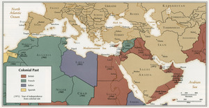
Colonial Past
2466.
Le Colonie Unite dell' America Settentr'le di nuova projezione a ss. ee. li signori riformatori dello studio di Padova : con...
2467.
Les Colonies des Européens en Amerique
2468.
The colonies in 1660, New England and New Netherland showing extent and dates of settlement
2469.
The colonies in 1660, Virginia, Maryland, and the Dutch and Swedish settlements on the Delaware showing extent and dates of...
2470.
Colony of Queensland (Australia)
2471.
The colour of an old city : a map of Boston, decorative and historical
2472.
Colton's Florida
2473.
Colton's general map of the United States : showing the railroad routes across the continent
2474.
Colton's Georgetown and the city of Washington : the capital of the United States of America ; Colton's map showing part of...
2475.
Colton's Map of the New York Wilderness
2476.
Colton's map of the New York Wilderness and the Adirondacks
2477.
Colton's map of the oil district of West Virginia and Ohio
2478.
Colton's map of the seat of war in Virginia : showing minutely the interesting localities in the vicinity of Richmond
2479.
Colton's map of the state of Indiana : compiled from the United States surveys & other authentic sources ; exhibiting sections,...
2480.
Colton's map of the territory of Alaska : (Russian America) ceded by Russia to the United States
‹ Prev
Next ›
1
2
…
120
121
122
123
124
125
126
127
128
…
669
670