Toggle navigation
LMEC Home
Exhibitions
Georeferencing
Tools for Teachers
Collections
My Favorites
Sign Up / Log In
Search
Search the map portal
Map Collection
Map Collection
Map Sets
Search
Search
Search for
Search In
All Fields
Creator
Title
Subject
Place
Search All Digital Collections
Advanced Search
10713 Results
My Search
Start Over
All Fields
americas
Remove constraint All Fields: americas
Filter your Search
Place
North and Central America
10,111
United States
8,243
Massachusetts
2,691
Suffolk (county)
1,662
Boston
1,619
Canada
936
New York
640
Middlesex (county)
424
more
Place
»
Topic
Boston (Mass.)--Maps
740
City planning--Massachusetts--Boston--Maps
418
United States--History--Revolution, 1775-1783--Maps
327
United States--Maps
313
Urban renewal--Massachusetts--Boston--Maps
254
Real property--Massachusetts--Boston--Maps
252
Massachusetts--Maps
219
Insurance surveys
194
more
Topic
»
Date
Date range begin
–
Date range end
Current results range from
1507
to
2023
View distribution
Creator
Boston Redevelopment Authority
403
United States. Hydrographic Office
365
Des Barres, Joseph F. W. (Joseph Frederick Wallet), 1722-1824
197
Jefferys, Thomas, -1771
150
George, III, King of Great Britain, 1738-1820
146
O.H. Bailey & Co
146
George, IV, King of Great Britain, 1762-1830
145
Royal United Services Institute for Defence and Security Studies
139
more
Creator
»
Format
Maps/Atlases
10,590
Manuscripts
916
Prints
60
Books
43
Drawings/Illustrations
43
Photographs
15
Objects/Artifacts
7
Posters
3
more
Format
»
Georeferenced
Yes
823
No
9,890
Collection
Norman B. Leventhal Map & Education Center Collection
6,479
American Revolutionary War-Era Maps
3,123
Boston and New England Maps
2,801
Urban Maps
2,249
William L. Clements Library Collection
892
Maritime Charts and Atlases
802
Library of Congress Collection
552
Boston Redevelopment Authority Collection
475
more
Collection
»
Available to use
No known restrictions
7,530
Creative Commons license
1,540
Search Constraints
Sort by relevance
relevance
title
date (asc)
date (desc)
Number of results to display per page
20 per page
10
per page
20
per page
50
per page
100
per page
View results as:
grid view
map view
Search Results
1661.
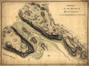
Sketch of the Heights of Kingsbridge, with the proposed redouts couloured yellow
1662.
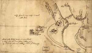
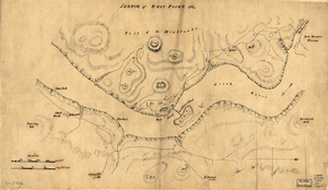
Sketch of the rebel works at West Point : as taken from the description of them given by a deserter who came to Stoney Point,...
1663.
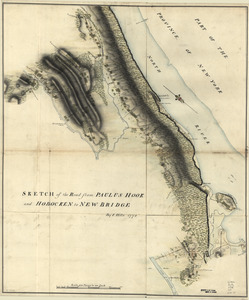
Sketch of the road from Paulus Hook and Hobocken to New Bridge
1664.
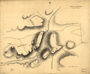
Sketch of the White Plains
1665.
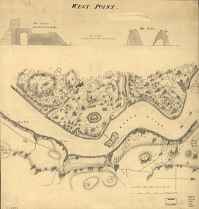
Sketch of West Point
1666.
A survey of the city of Philadelphia and its environs : shewing the several works constructed by His Majesty's troops, under...
1667.
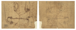
A tracing relating to Fort Washington or Knyphausen
1668.
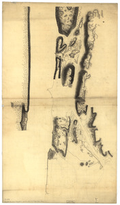
Unfinished draught for a topographical map of the northern part of New York Island
1669.
West Point
1670.
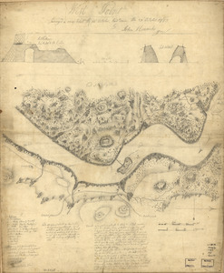
West Point : surveyed a coup d'oeil the 24th October, laid down the 27th October 1783
1671.
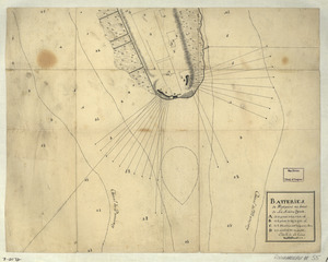
Batteries de West-point au haut de la Rivière d'York
1672.
Carte de la Nouvelle Angleterre, New York, Pensilvanie et Nouveau Jersay suivant les cartes angloises
1673.
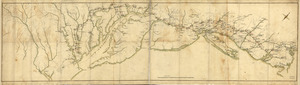
Côte de York-town à Boston: Marches de l'armée
1674.
A draught of Lake George, and part of Hudson's River taken September 1756
1675.
Fort La Fayette on Verplancks Point, with British and Hessian troop positions
1676.
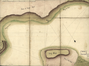
Frog's Point avec batteries de Partie de Longue Island
1677.
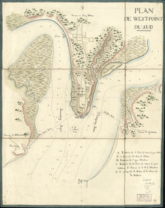
Plan de West-Point du Sud
1678.
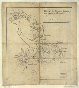
Plan des environs de Williamsburg, York, Hampton, et Portsmouth
1679.
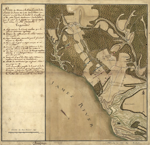
Plan du terrein à la rive gauche de la rivière de James vis-à-vis Jamestown en Virginie : ou s'est livré le combat du 6...
1680.
Plan of a rout undertaken in winter, Jany. 26th : from Quebec, the capital of Canada, to the frontier settlements of the...
‹ Prev
Next ›
1
2
…
80
81
82
83
84
85
86
87
88
…
535
536