Toggle navigation
LMEC Home
Exhibitions
Georeferencing
Tools for Teachers
Collections
My Favorites
Sign Up / Log In
Search
Search the map portal
Map Collection
Map Collection
Map Sets
Search
Search
Search for
Search In
All Fields
Creator
Title
Subject
Place
Search All Digital Collections
Advanced Search
4130 Results
My Search
Start Over
Date Range
before 1800
Remove constraint Date Range: before 1800
All Fields
americas
Remove constraint All Fields: americas
Filter your Search
Place
North and Central America
3,720
United States
2,492
Canada
642
Massachusetts
471
New York
376
North America
307
South America
204
Maine
203
more
Place
»
Topic
United States--History--Revolution, 1775-1783--Maps
321
North America--Maps--Early works to 1800
179
United States--History--French and Indian War, 1754-1763--Maps
161
Manuscript maps--Early works to 1800
121
New England--Maps--Early works to 1800
89
America--Maps--Early works to 1800
73
United States--Maps--Early works to 1800
59
Western Hemisphere--Maps--Early works to 1800
59
more
Topic
»
Date
Date range begin
–
Date range end
Current results range from
1507
to
1899
View distribution
Creator
Des Barres, Joseph F. W. (Joseph Frederick Wallet), 1722-1824
196
Jefferys, Thomas, -1771
149
George, III, King of Great Britain, 1738-1820
146
George, IV, King of Great Britain, 1762-1830
145
Royal United Services Institute for Defence and Security Studies
137
Amherst, Jeffery Amherst, Baron, 1717-1797
110
Sayer, Robert, 1725-1794
99
Faden, William, 1749-1836
93
more
Creator
»
Format
Maps/Atlases
4,048
Manuscripts
739
Drawings/Illustrations
36
Prints
34
Books
8
Objects/Artifacts
3
Documents
1
Ephemera
1
Georeferenced
Yes
113
No
4,017
Collection
American Revolutionary War-Era Maps
3,095
Norman B. Leventhal Map & Education Center Collection
1,168
William L. Clements Library Collection
887
Library of Congress Collection
552
Town plans, 1794
401
British Library Collection
346
Maritime Charts and Atlases
331
Richard H. Brown Revolutionary War Map Collection at Mount Vernon
274
more
Collection
»
Available to use
No known restrictions
1,527
Creative Commons license
1,430
Search Constraints
Sort by relevance
relevance
title
date (asc)
date (desc)
Number of results to display per page
20 per page
10
per page
20
per page
50
per page
100
per page
View results as:
grid view
map view
Search Results
301.
A new and accurate map of the present seat of war in North America : from a late survey
302.
Pensylvania Nova Jersey et Nova York cum Regionibus ad Fluvium Delaware in America sitis
303.
A chart of the coast of America from New found Land to Cape Cod
304.
Mapa, que comprende la Frontera, de los Dominios del Rey, en la America Septentrional
305.
Chart containing part of the Icy Sea with the adjacent coast of Asia and America
306.
Map of the European settlements in South America and on the western coast of Africa
307.
Mappa fluxus et refluxus rationes in isthmo Americano, in Freto Magellanico, cæterisque Americæ litoribus exhibens
308.
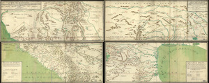
[A map of the east coast of America from Newfoundland to the Bay of Honduras]
309.
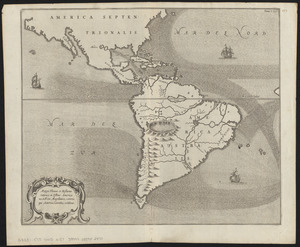
America with those known parts in that unknowne worlde both people and manner of buildings
310.
America with those known parts in that unknowne worlde both people and manner of buildings
311.
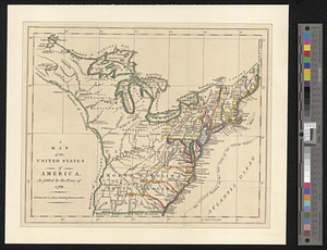
A map of the United States of America, as settled by the peace of 1783
312.
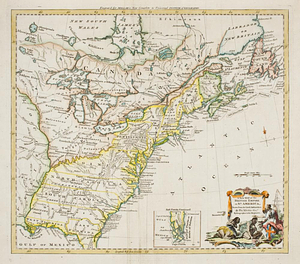
The United States of North America, with the British & Spanish territories according to the treaty
313.
An accurate map of the English colonies in North America, bordering on the river Ohio
314.
Chart of the coast of America from the Nd. of St. Augustin to Ayes Inlet
315.
A map of the West-Indies or the islands of America in the North Sea : with ye adjacent countries; explaning [sic] what belongs...
316.
A map of the West-Indies or the islands of America in the North Sea : with ye adjacent countries; explaning [sic] what belongs...
317.
A map of the United States of America as settled by the peace of 1783
318.
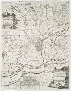
A map of that part of Pennsylvania now the principal seat of war in America : wherein may be seen the situation of...
319.
The United States of North America with the British & Spanish territories according to the treaty
320.
A new map of the British empire in Nth. America, drawn from the latest authorities
‹ Prev
Next ›
1
2
…
12
13
14
15
16
17
18
19
20
…
206
207


![[A map of the east coast of America from Newfoundland to the Bay of Honduras]](https://bpldcassets.blob.core.windows.net/derivatives/images/commonwealth:hx11z584h/image_thumbnail_300.jpg)