Toggle navigation
LMEC Home
Exhibitions
Georeferencing
Tools for Teachers
Collections
My Favorites
Sign Up / Log In
Search
Search the map portal
Map Collection
Map Collection
Map Sets
Search
Search
Search for
Search In
All Fields
Creator
Title
Subject
Place
Search All Digital Collections
Advanced Search
10179 Results
My Search
Start Over
All Fields
americas
Remove constraint All Fields: americas
Filter your Search
Place
North and Central America
9,353
United States
6,859
Suffolk (county)
1,662
Boston
1,619
Canada
833
Massachusetts
794
New York
532
Middlesex (county)
424
more
Place
»
Topic
Boston (Mass.)--Maps
740
City planning--Massachusetts--Boston--Maps
418
United States--History--Revolution, 1775-1783--Maps
327
Urban renewal--Massachusetts--Boston--Maps
254
Real property--Massachusetts--Boston--Maps
252
Massachusetts--Maps
219
Insurance surveys
194
Fire risk assessment
193
more
Topic
»
Date
Date range begin
–
Date range end
Current results range from
1507
to
2023
View distribution
Creator
Boston Redevelopment Authority
403
United States. Hydrographic Office
332
Des Barres, Joseph F. W. (Joseph Frederick Wallet), 1722-1824
189
Jefferys, Thomas, -1771
150
George, III, King of Great Britain, 1738-1820
146
O.H. Bailey & Co
146
George, IV, King of Great Britain, 1762-1830
145
Royal United Services Institute for Defence and Security Studies
139
more
Creator
»
Format
Maps/Atlases
10,059
Manuscripts
912
Prints
58
Drawings/Illustrations
43
Books
42
Photographs
15
Objects/Artifacts
6
Ephemera
2
more
Format
»
Georeferenced
Yes
754
No
9,425
Collection
Norman B. Leventhal Map Center Collection
5,945
American Revolutionary War-Era Maps
3,085
Boston and New England Maps
2,801
Urban Maps
2,248
William L. Clements Library Collection
892
Maritime Charts and Atlases
726
Library of Congress Collection
552
Boston Redevelopment Authority Collection
475
more
Collection
»
Available to use
No known restrictions
7,066
Creative Commons license
1,539
Search Constraints
Sort by relevance
relevance
title
date (asc)
date (desc)
Number of results to display per page
20 per page
10
per page
20
per page
50
per page
100
per page
View results as:
grid view
map view
Search Results
3241.
Colton's map of the oil district of West Virginia and Ohio
3242.
Colton's map of the seat of war in Virginia : showing minutely the interesting localities in the vicinity of Richmond
3243.
Colton's Massachusetts and Rhode Island
3244.
Colton's rail road and county map of the Southern States containing the latest information
3245.
Columbia County, Wis.
3246.
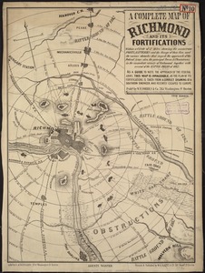
A complete map of Richmond and its fortifications within a circle of 12 miles showing the numerous forts, batteries and the...
3247.
Confluence of the James River, York River, and Chesapeake Bay
3248.
Connecticut
3249.
Connecticut
3250.
Connecticut from the best authorities
3251.
[Continuation of Plan du detroit de Belle Isle et du Golphe St. Laurent]
3252.
Conway Harbour : Port Aylesbury
3253.
Copie de la carte de Monsieur Klam ou l'on voit les sources e la riviere d'Orange suivant de nouvelles observation
3254.
Copy of a plan of York harbour with the soundings, shoals &c. surveyed by order of Lt Governor Simcoe
3255.
Cortland, N.Y : 1873
3256.
The cotton kingdom
3257.
The country of So red the rose, by Stark Young, Scribners
3258.
County atlas of Berkshire Massachusetts
3259.
County atlas of Hampshire, Massachusetts
3260.
County atlas of Hampshire, Massachusetts : from actual surveys
‹ Prev
Next ›
1
2
…
159
160
161
162
163
164
165
166
167
…
508
509


![[Continuation of Plan du detroit de Belle Isle et du Golphe St. Laurent]](https://bpldcassets.blob.core.windows.net/derivatives/images/commonwealth:z603vm96n/image_thumbnail_300.jpg)