Map of the town of Rochester, Plymouth County, Massachusetts : surveyed by order of the town
Item Information
- Title:
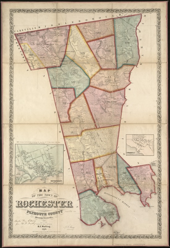
- Map of the town of Rochester, Plymouth County, Massachusetts : surveyed by order of the town
- Creator:
- Walling, Henry Francis, 1825-1888
- Name on Item:
-
by H.F. Walling ; A.S. Mowry, assistant engr.
- Date:
-
1856
- Format:
-
Maps/Atlases
- Location:
-
Boston Public Library
Norman B. Leventhal Map & Education Center - Collection (local):
-
Norman B. Leventhal Map & Education Center Collection
- Subjects:
-
Real property--Massachusetts--Rochester (Town)--Maps
Landowners--Massachusetts--Rochester (Town)--Maps
Real property--Massachusetts--Mattapoisett (Town)--Maps
Landowners--Massachusetts--Mattapoisett (Town)--Maps
Rochester (Mass. : Town)--Maps
Mattapoisett (Mass. : Town)--Maps
- Places:
-
MassachusettsPlymouth (county)Rochester
MassachusettsPlymouth (county)Mattapoisett
- Extent:
- 1 map : hand col. ; 90 x 59 cm.
- Terms of Use:
-
No known copyright restrictions.
No known restrictions on use.
- Publisher:
-
N[ew] Y[ork] :
Lith. of F. Mayer & Co.
- Scale:
-
Scale [ca. 1:24,170].
- Language:
-
English
- Notes:
-
Shows buildings with names of property owners and town districts.
Covers the towns of Rochester and Mattapoisett.
Relief shown by hachures.
"Entered according to act of Congress in the Clerks Office of the District of Massachusetts, A.D. 1856."
Insets: Mattapoisett. Scale 1:6,000 -- Cannonville. Scale 1:5,000.
- Identifier:
-
06_01_005438
- Call #:
-
G3764.R62G46 1856 .W3
- Barcode:
-
39999059014306


