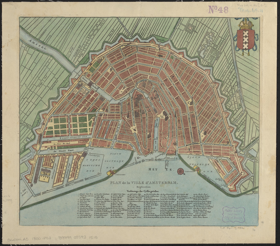
Plan de la ville d'Amsterdam
Item Information
- Title:
- Plan de la ville d'Amsterdam
- Date:
-
[ca. 1810–1840]
- Format:
-
Maps/Atlases
- Location:
-
Boston Public Library
Norman B. Leventhal Map & Education Center - Collection (local):
-
Norman B. Leventhal Map & Education Center Collection
- Subjects:
-
Amsterdam (Netherlands)--Maps
- Places:
-
NetherlandsNorth Holland (province)Amsterdam
- Extent:
- 1 map : color ; 36 x 42 cm.
- Terms of Use:
-
No known copyright restrictions.
No known restrictions on use.
- Publisher:
-
[Place of publication not identified] :
[publisher not identified]
- Scale:
-
Scale approximately 1:10,500
- Language:
-
Dutch
French
- Notes:
-
Date of publication estimated from city structures and features.
Oriented with north to lower right.
Includes "Verklaringe der Cyffer getallen" listing 110 sites keyed to numbers on the map.
Includes illustration of coat of arms of Amsterdam.
Some buildings shown pictorially.
Title in French. Map and key in Dutch.
- Identifier:
-
06_01_015103
- Call #:
-
G6004.A5 1800 .P53
- Barcode:
-
39999085931515


