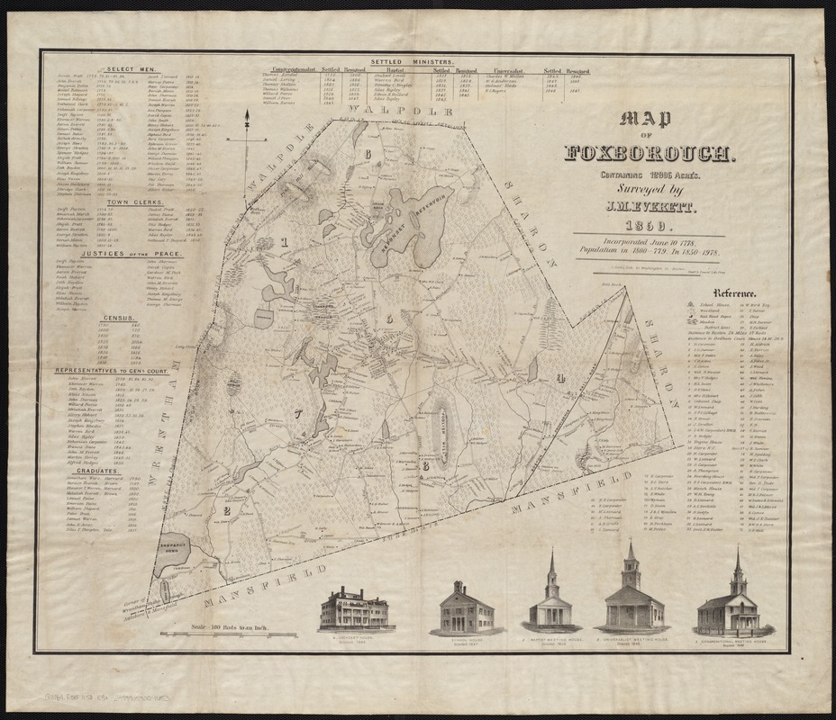
Map of Foxborough : containing 12806 acres
Item Information
- Title:
- Map of Foxborough : containing 12806 acres
- Creator:
- Everett, J. M.
- Name on Item:
-
surveyed by J.M. Everett.
- Date:
-
1850
- Format:
-
Maps/Atlases
- Location:
-
Boston Public Library
Norman B. Leventhal Map & Education Center - Collection (local):
-
Norman B. Leventhal Map & Education Center Collection
- Subjects:
-
Landowners--Massachusetts--Foxboro--Maps
Foxboro (Mass.)--Maps
- Places:
-
MassachusettsNorfolk (county)Foxboro
- Extent:
- 1 map ; 54 x 68 cm.
- Terms of Use:
-
No known copyright restrictions.
No known restrictions on use.
- Publisher:
-
S.l :
[s.n.]
- Scale:
-
Scale [ca. 1:19,800].
- Language:
-
English
- Notes:
-
Relief shown by hachures.
"C. Cook's Lith., 81 Washington St., Boston."
"Sweet & Powers' Lith. Press."
Includes five ill., references and numerous lists.
- Identifier:
-
06_01_004170
- Call #:
-
G3764.F65 1850 .E9x
- Barcode:
-
39999059004653


