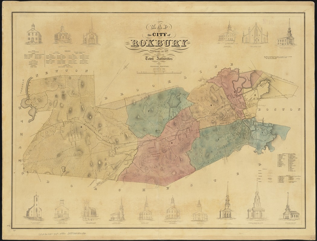
Map of the city of Roxbury
Item Information
- Title:
- Map of the city of Roxbury
- Creator:
- Whitney, Charles.
- Name on Item:
-
surveyed in 1843 by order of the town authorities by Charles Whitney.
- Date:
-
1849
- Format:
-
Maps/Atlases
- Location:
-
Boston Public Library
Norman B. Leventhal Map & Education Center - Collection (local):
-
Norman B. Leventhal Map & Education Center Collection
- Subjects:
-
Roxbury (Boston, Mass.)--Mass
- Places:
-
MassachusettsSuffolk (county)BostonRoxbury
- Extent:
- 1 map : col. ; 60 x 81 cm.
- Terms of Use:
-
No known copyright restrictions.
No known restrictions on use.
- Publisher:
-
Boston, Mass :
[s.n.]
- Scale:
-
Scale not given.
- Language:
-
English
- Notes:
-
Oriented with north toward the upper right.
Relief shown by hachures.
Includes index and sixteen views of churches.
- Identifier:
-
06_01_003866
- Call #:
-
G3764.B6:2R7 1849 .W55x
- Barcode:
-
39999059002392


