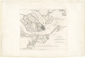
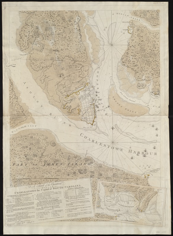
A sketch of the operations before Charlestown the capital of South Carolina
This map is also available in American Revolutionary Geographies Online (ARGO), a collections portal especially built for material relating to the American Revolutionary War Era. Visit ARGO to learn more about this item and explore the historical geography of North America in the late eighteenth century.
Item Information
- Title:
- A sketch of the operations before Charlestown the capital of South Carolina
- Description:
-
In 1780, the British tried to capture Charleston, South Carolina again. This chart depicts the six-week siege that forced American troops to surrender on May 12, 1780. This was the largest surrender of American troops during the war. Along with Samuel Holland, Joseph F.W. Des Barres conducted extensive coastal surveys of the British colonies beginning in 1764. Although their charts were prepared primarily for navigational purposes, this one features the fortifications constructed by British and American troops (colored yellow) and the British and American fleets. This version of the chart appeared in Des Barres’ The Atlantic Neptune, the most comprehensive maritime atlas of the period.
- Creator:
- Des Barres, Joseph F. W. (Joseph Frederick Wallet), 1722-1824
- Date:
-
[1780]
- Format:
-
Maps/Atlases
- Location:
-
Boston Public Library
Norman B. Leventhal Map & Education Center - Collection (local):
-
Norman B. Leventhal Map & Education Center Collection
- Subjects:
-
Charleston (S.C.)--History--Siege, 1780--Maps--Early works to 1800
- Places:
-
South CarolinaCharleston (county)Charleston
- Extent:
- 1 map : hand col. ; 102 x 73 cm.
- Terms of Use:
-
No known copyright restrictions.
No known restrictions on use.
- Publisher:
-
London :
J.F.W. Des Barres
- Scale:
-
Scale [ca. 1:11,800]
- Language:
-
English
- Notes:
-
1st state.
Hand colored.
Includes descriptive index and inset "Charlestown Harbour," ca. 1:430,000.
Appears in the author's Atlantic Neptune pt.3, no.18. London : [J.F.W. Des Barres], 1777-[1781].
This map can be viewed as a georeferenced overlay in an interactive application made especially for We Are One: Mapping America's Road from Revolution to Independence http://d2o8owo4k087al.cloudfront.net/index.html?mapId=82.
- Notes (date):
-
This date is inferred.
- Notes (exhibitions):
-
Exhibited: "We Are One: Mapping America's Road from Revolution to Independence" organized by the Norman B. Leventhal Map Center at the Boston Public Library, 2015.
- Identifier:
-
06_01_004994
- Call #:
-
G1106.P5 D47 1777
- Barcode:
-
30000003813674
- LCCN:
-
73691556