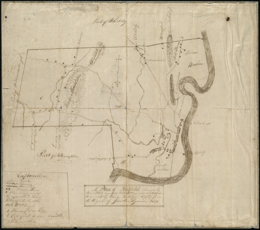
A plan of Hatfield
Item Information
- Title:
- A plan of Hatfield
- Creator:
- Lyman, Jonathan Huntington, 1783-1825
- Name on Item:
-
surveyed by Ebenr. Fitch Nov. 1795 ; protracted on a scale of 200 rods to an inch by Oliver Partridge ; copied from the original by Jonathan Lyman 1801.
- Date:
-
1801
- Format:
-
Maps/Atlases
Manuscripts
- Location:
-
Boston Public Library
Norman B. Leventhal Map & Education Center - Collection (local):
-
Norman B. Leventhal Map & Education Center Collection
- Subjects:
-
Hatfield (Mass. : Town)--Maps, Manuscript
- Places:
-
MassachusettsHampshire (county)Hatfield
- Extent:
- 1 ms. map ; on sheet 31 x 35 cm.
- Terms of Use:
-
No known copyright restrictions.
No known restrictions on use.
- Scale:
-
Scale ca. 1:39,600.
- Language:
-
English
- Notes:
-
Relief shown by hachures.
Pen-and-ink on tissue backed paper.
Includes legend to places of interest.
From dealer description: "This map is based, though with some interesting alterations, on a prototype surveyed in November 1794 by Ebenezer Fitch and 'protracted' by Oliver Partridge. This prototype was submitted to the Secretary of the Commonwealth of Massachusetts, used by Osgood Carleton when compiling his Accurate Map of the Commonwealth of Massachusetts (1797), and now resides in the Massachusetts State Archives."
- Identifier:
-
06_01_005741
- Call #:
-
G3764.H22 1801 .L96
- Barcode:
-
39999059016889


