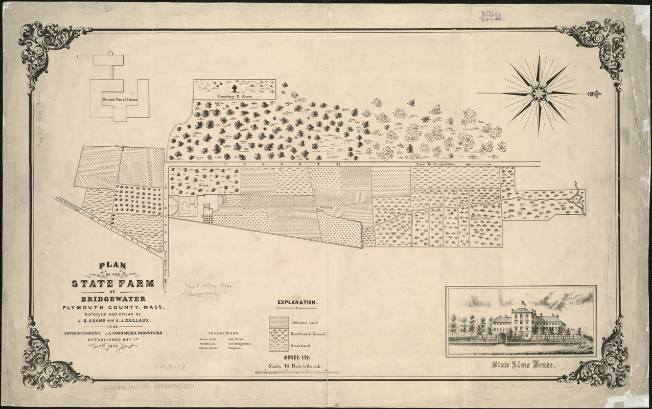
Plan of the state farm at Bridgewater, Plymouth County, Mass
Item Information
- Title:
- Plan of the state farm at Bridgewater, Plymouth County, Mass
- Creator:
- Adams, J. Q.
- Name on Item:
-
surveyed and drawn by J.Q. Adams and A.J. Caillaux.
- Date:
-
1862
- Format:
-
Maps/Atlases
- Location:
-
Boston Public Library
Norman B. Leventhal Map & Education Center - Collection (local):
-
Norman B. Leventhal Map & Education Center Collection
- Subjects:
-
Massachusetts Correctional Institution, Bridgewater--Maps
Real property--Massachusetts--Bridgewater (Town)--Maps
Almshouses--Massachusetts--Bridgewater (Town)--Maps
Bridgewater (Mass. : Town)--Maps
- Places:
-
MassachusettsPlymouth (county)Bridgewater
- Extent:
- 1 map ; 42 x 71 cm.
- Terms of Use:
-
No known copyright restrictions.
No known restrictions on use.
- Publisher:
-
Barnstable, Mass :
[L.L. Goodspeed]
- Scale:
-
Scale [1:3,168].
- Language:
-
English
- Notes:
-
Oriented with north to the right.
Shows lands of state farm along Conant St.
Includes view: State Alms House, and ground plan of house.
- Identifier:
-
06_01_005293
- Call #:
-
G3764.B75 1862 .A3x
- Barcode:
-
39999059012557


