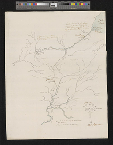
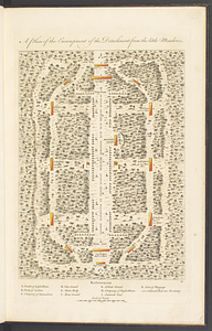
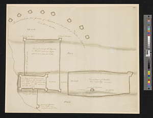
General Wayne's encampment & establishment at Roche de Bout
This map is also available in American Revolutionary Geographies Online (ARGO), a collections portal especially built for material relating to the American Revolutionary War Era. Visit ARGO to learn more about this item and explore the historical geography of North America in the late eighteenth century.
Item Information
- Title:
- General Wayne's encampment & establishment at Roche de Bout
- Date:
-
[1794]
- Format:
-
Maps/Atlases
- Genre:
-
Manuscript maps
- Location:
- William L. Clements Library
- Collection (local):
-
William L. Clements Library Collection
- Subjects:
-
Fallen Timbers, Battle of, Ohio, 1794--Maps
Wayne's Campaign, 1794--Maps
Military camps--Maps
Roche de Boeuf (Ohio)--Maps
Wayne, Anthony, 1745-1796
- Places:
-
OhioLucas (county)Roche de Boeuf (island)
- Extent:
- 1 ms. map : gray wash ; 33 x 42 cm
- Terms of Use:
-
The University of Michigan Library provides access to these materials for educational and research purposes. These materials may be under copyright. If you decide to use any of these materials, you are responsible for making your own legal assessment and securing any necessary permission. If you have questions about the collection, please contact the William L. Clements Library.
Contact host institution for more information.
- Scale:
-
Scale ca. 1:2,520.
- Language:
-
English
- Catalog Record:
-
Catalog record
- Notes:
-
Title from verso.
Pen and ink, topographical plan showing Wayne's encampment before the Battle of Fallen Timbers.
Notations provide details on construction of the fortifications and numbers of troops stationed in them.
Clinton Maps 345.
- Notes (date):
-
This date is inferred.
- Identifier:
-
1833
- Barcode:
-
B1938593