Toggle navigation
LMEC Home
Exhibitions
Georeferencing
Tools for Teachers
Collections
My Favorites
Sign Up / Log In
Search
Search the map portal
Map Collection
Map Collection
Map Sets
Search
Search
Search for
Search In
All Fields
Creator
Title
Subject
Place
Search All Digital Collections
Advanced Search
44 Results
My Search
Start Over
Date
1930
Remove constraint Date: <span class='single'>1930</span>
Filter your Search
Place
North and Central America
41
United States
38
Massachusetts
14
Suffolk (county)
10
Boston
9
Middlesex (county)
6
New England
5
Wakefield
4
more
Place
»
Topic
Fire risk assessment
5
Insurance surveys
5
Textile factories
4
Boston (Mass.)--Maps
3
New England--Maps--Early works to 1800--Facsimiles
3
Boone, Daniel, 1734-1820
2
City planning--Massachusetts--Boston--Maps
2
Farnsworth Manufacturing Co.
2
more
Topic
»
Date
1930
[remove]
44
Date range begin
–
Date range end
Current results range from
1770
to
1999
1930
to
1930
44
Creator
Associated Factory Mutual Fire Insurance Companies
4
Bridge, Edward Melville, 1890-
2
Tudor Press
2
Wakefield Item Company
2
American Association of University Women. Salina Branch
1
Bailey, Frederic T.
1
Bancroft, Clinton L.
1
Boston (Mass.). City Planning Board
1
more
Creator
»
Format
Maps/Atlases
43
Photographs
1
Georeferenced
Yes
3
No
41
Collection
Norman B. Leventhal Map & Education Center Collection
31
Boston and New England Maps
8
Urban Maps
6
American Textile History Museum Image Collection
5
Lucius Beebe Memorial Library Historic Maps
4
Boston Redevelopment Authority Collection
2
American Revolutionary War-Era Maps
1
Massachusetts Real Estate Atlases
1
more
Collection
»
Available to use
No known restrictions
34
Creative Commons license
3
Search Constraints
Sort by relevance
relevance
title
date (asc)
date (desc)
Number of results to display per page
20 per page
10
per page
20
per page
50
per page
100
per page
View results as:
grid view
map view
Search Results
1.
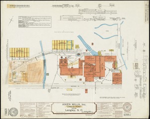
Aiken Mills, Inc. "Langley Plant" (Cotton), Langley, S.C.
2.
Atlas of the city of Cambridge, Massachusetts : from actual surveys and official plans
3.
Birdsboro, Pa. : settled 1740
4.
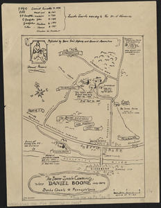
The Boone-Lincoln community where Daniel Boone was born, Berks County, Pennsylvania
5.
Boston thorofare plan existing routes and proposals
6.
Caucasus, Central Asia and Turkey
7.
A chart of the gulf stream
8.
Clearwater Manufacturing Company (Finishing Plant), Clearwater, S.C. [insurance map]
9.
A draught of St. John's harbour : with the soundings
10.
The facts of prohibition in the United States
11.
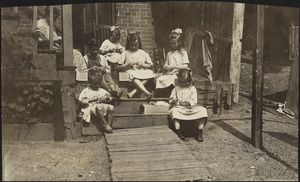
Family of Mrs. Donovan, Roxbury
12.
Farnsworth Company, Lisbon, Me., Tenements, P.O. Lisbon Centre, Me. [insurance map]
13.
Farnsworth Company (Wool), Lisbon, Me. P.O. Lisbon Centre, Me. [insurance map]
14.
Historical map of the town of Scituate, Plymouth County, Massachusetts, incorporated 1636
15.
Historical map of Watertown, 1630-1930
16.
Lawrence Wholesale Drug Company (Warehouse), Lawrence, Mass. [insurance map]
17.
Map of Connecticut, circa 1625, Indian trails, villages, sachemdoms
18.
A map of New England and New York
19.
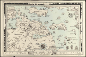
A map of Portsmouth, N.H. : an old town by the sea
20.
Map of the Back Bay Fens showing the public ways bordering and crossing them and the neighboring newly laid out parts of...
‹ Prev
Next ›
1
2
3


![Clearwater Manufacturing Company (Finishing Plant), Clearwater, S.C. [insurance map]](https://bpldcassets.blob.core.windows.net/derivatives/images/commonwealth:2r36vc319/image_thumbnail_300.jpg)


![Farnsworth Company, Lisbon, Me., Tenements, P.O. Lisbon Centre, Me. [insurance map]](https://bpldcassets.blob.core.windows.net/derivatives/images/commonwealth:4j03df31d/image_thumbnail_300.jpg)
![Farnsworth Company (Wool), Lisbon, Me. P.O. Lisbon Centre, Me. [insurance map]](https://bpldcassets.blob.core.windows.net/derivatives/images/commonwealth:2r36vc212/image_thumbnail_300.jpg)


![Lawrence Wholesale Drug Company (Warehouse), Lawrence, Mass. [insurance map]](https://bpldcassets.blob.core.windows.net/derivatives/images/commonwealth:ww72bz08d/image_thumbnail_300.jpg)