Toggle navigation
LMEC Home
Exhibitions
Georeferencing
Tools for Teachers
Collections
My Favorites
Sign Up / Log In
Search
Search the map portal
Map Collection
Map Collection
Map Sets
Search
Search
Search for
Search In
All Fields
Creator
Title
Subject
Place
Search All Digital Collections
Advanced Search
119 Results
My Search
Start Over
Date
1846
Remove constraint Date: <span class='single'>1846</span>
Filter your Search
Place
North and Central America
51
United States
40
Oceania
32
Massachusetts
22
Europe
16
French Polynesia
9
Suffolk (county)
9
Boston
8
more
Place
»
Topic
United States Exploring Expedition (1838-1842)
16
Boston (Mass.)--Maps
6
Tuamotu Archipelago (French Polynesia)--Maps
6
China--Maps
5
Massachusetts--Maps
5
Railroads--Massachusetts--Maps
5
Korea--Maps
4
Nautical charts--Fiji--Vanua Levu
3
more
Topic
»
Date
1846
[remove]
119
Date range begin
–
Date range end
Current results range from
1770
to
1990
1846
to
1846
119
Creator
United States Exploring Expedition (1838-1842)
34
Wilkes, Charles, 1798-1877
31
Sherman & Smith
19
Boynton, George W., -1884
3
Knight, J. (Engraver)
3
Collinson, Richard, Sir, 1811-1883
2
Copley, Charles
2
Duvotenay, Th. (Thunot), 1796-1875
2
more
Creator
»
Format
Maps/Atlases
118
Manuscripts
14
Prints
1
Georeferenced
Yes
11
No
108
Collection
Norman B. Leventhal Map & Education Center Collection
102
Maritime Charts and Atlases
38
Urban Maps
21
Boston and New England Maps
19
American Revolutionary War-Era Maps
12
Library of Congress Collection
5
MacLean Collection Map Library
4
Newberry Library Collection
2
more
Collection
»
Available to use
No known restrictions
104
Creative Commons license
6
Search Constraints
Sort by relevance
relevance
title
date (asc)
date (desc)
Number of results to display per page
20 per page
10
per page
20
per page
50
per page
100
per page
View results as:
grid view
map view
Search Results
1.
1. Prise de Newport par d'Estaing, 1778 : 2. Embossage de Ternay à Newport, 1780
2.
Afrika
3.
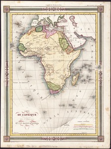
Afrique
4.
Ahii and Manhii or Peacock and Wilsons Islands
5.
America settle
6.
Antilles ou Indes Occidentales
7.
Apolima, Samoan Group ; Harbour of Oafonu, Isld. of Tutuila, north side ; Harbour of Aur, Isld. of Tutuila, north side ;...
8.
Athens
9.
Bay of Massefao, island of Tutuila ; Bay of Fagaitui, island of Tutuila ; Sketch of Aluau Bay, 1839 ; Sketch of Anuu Island, 1839
10.
Bradshaw's plan of Paris, and map of the environs
11.
Carl Jügel's post u. reise karte von Deutschland und den nachbar staaten, bis London, Paris, Montpellier, Florenz, Warschau,...
12.
Carte de l'Afrique
13.
Carte de l'Amérique Septentrionale
14.
Channel on the north side of Vanua Levu from Aramula Passage to Muthuata Island, Feejee Islands
15.
A chart of the gulf stream
16.
Chart of the Viti Group or Feejee Islands
17.
China : sheet IV south coast from Chauan Bay to Port Matheson including the Pescadore Islands
18.
China : sheet V eastern coast from Port Matheson to Ragged Point
19.
Coast of North America from Point Judith to St. Antonio, (island of Cuba) including the Bahama Banks
20.
Colombie et Guyanes
‹ Prev
Next ›
1
2
3
4
5
6