Toggle navigation
LMEC Home
Exhibitions
Georeferencing
Tools for Teachers
Collections
My Favorites
Sign Up / Log In
Search
Search the map portal
Map Collection
Map Collection
Map Sets
Search
Search
Search for
Search In
All Fields
Creator
Title
Subject
Place
Search All Digital Collections
Advanced Search
58 Results
My Search
Start Over
Date
1825
Remove constraint Date: <span class='single'>1825</span>
Filter your Search
Place
North and Central America
39
United States
29
Massachusetts
10
Europe
7
Boston
6
Suffolk (county)
6
New York
4
North Korea
4
more
Place
»
Topic
Boston (Mass.)--Maps
4
Korea--Maps
4
China--Maps
3
World maps
3
Anglo-French War, 1778-1783--Naval operations--Maps
2
Apalachicola River Region (Fla.)--Maps, Manuscript
2
Japan--Maps
2
Landowners--Florida--Apalachicola River Region--Maps
2
more
Topic
»
Date
1825
[remove]
58
Date range begin
–
Date range end
Current results range from
1770
to
1990
1825
to
1825
58
Creator
Arrowsmith, Aaron, 1750-1823
1
Baldwin, Jonah
1
Barker, William
1
Belleyme, M.
1
Bowen, Abel, 1790-1850
1
Buchon, J. A. C. (Jean Alexandre C.), 1791-1846
1
Carey, Mathew, 1760-1839
1
Carleton, Osgood, 1742-1816
1
more
Creator
»
Format
Maps/Atlases
58
Manuscripts
15
Georeferenced
Yes
7
No
51
Collection
Norman B. Leventhal Map & Education Center Collection
38
American Revolutionary War-Era Maps
14
Boston and New England Maps
8
Library of Congress Collection
5
MacLean Collection Map Library
4
Urban Maps
4
American Antiquarian Society Collection
2
Maritime Charts and Atlases
2
more
Collection
»
Available to use
No known restrictions
40
Creative Commons license
7
Search Constraints
Sort by relevance
relevance
title
date (asc)
date (desc)
Number of results to display per page
20 per page
10
per page
20
per page
50
per page
100
per page
View results as:
grid view
map view
Search Results
1.
1. Prise de Newport par d'Estaing, 1778 : 2. Embossage de Ternay à Newport, 1780
2.
Afrika
3.
Afrique
4.
America
5.
America settle
6.
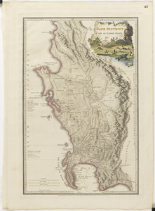
Cape District, Cape of Good Hope
7.
Carte générale des États-Unis de l'Amérique avec les plans des principales villes
8.
Carte géographique, statistique et historique de Massachusetts
9.
Carte routière des environs de Paris, divisés par departemens, arrondissemens communaux et cantons
10.
Chart of Portland Harbour and islands, and harbours adjacent, extending from the river Kennebec to Wood Island and Winter...
11.
A chart of the gulf stream
12.
Chart of the world, on Mercator's projection : illustrative of the impolicy of slavery
13.
The County of Essex from actual survey
14.
Dongguk yojido
15.
Geological map of part of Jamaica
16.
Haejwa do
17.
[Isthmus of Tehuantepec, Mexico]
18.
Italiæ antiquæ et novæ
19.
Joseon yojido
20.
[Manuscript map of coast from Maine to Delaware]
‹ Prev
Next ›
1
2
3


![[Isthmus of Tehuantepec, Mexico]](https://bpldcassets.blob.core.windows.net/derivatives/images/commonwealth:4m90fj46g/image_thumbnail_300.jpg)
![[Manuscript map of coast from Maine to Delaware]](https://bpldcassets.blob.core.windows.net/derivatives/images/commonwealth:x633f976h/image_thumbnail_300.jpg)